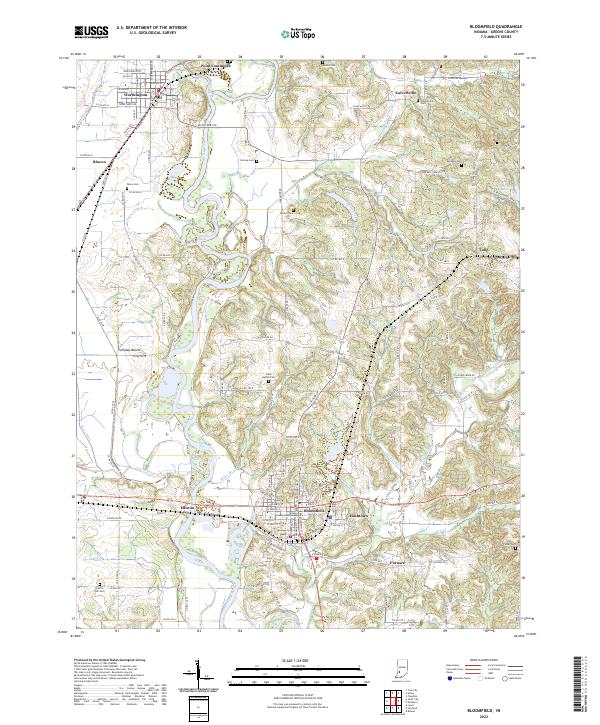
2022 Map of Bloomfield
USGS Topo · Published 2022About this map
The Greene County Courthouse serves as the central anchor for Bloomfield, situated above the winding White River in this modern topographic study of southern Indiana. The landscape is defined by the convergence of several significant watercourses, including Richland Creek and Lattas Creek, which carve through the terrain south of Worthington. Local heritage is preserved in numerous scattered burial sites such as Stalcup Cem, Owens Cem, and Castle Hill Cem, providing important touchstones for genealogical research in the region.
Find a feature on this map
135 named features on this map. Tap any name to fly to it.
Don’t see what you’re looking for? This feature index may not catch every label — zoom into the map to look around manually.
Map Details
Editions of this 2022 Bloomfield Map
This is the sole edition of this map. No revisions or reprints were ever made.
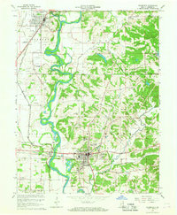
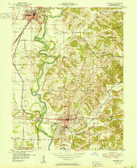
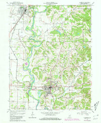
Historical Maps of Furnace Through Time
4 maps found