
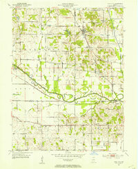
1951 Map of Bloomfield
USGS Topo · Published 1951About this map
Bloomfield and Worthington anchor this mid-century survey of the West Fork White River valley. The map reveals a landscape defined by the confluence of the Eel River and numerous tributaries like Richland Creek and Lattas Creek, where the river’s meandering path has created a wide floodplain between the higher ground of Highland and Richland townships. The transportation network is particularly dense, showing several major rail lines including the Illinois Central, New York Central, and Pennsylvania railroads crossing the river and connecting small communities like Elliston and Rincon.
Find a feature on this map
54 named features on this map. Tap any name to fly to it.
Don’t see what you’re looking for? This feature index may not catch every label — zoom into the map to look around manually.
Map Details
Editions of this 1951 Bloomfield Map
This is the sole edition of this map. No revisions or reprints were ever made.
Other maps of this area

1908 · Bloomfield
USGS Topo · 1:62,500

1938 · Coal City
USGS Topo · 1:24,000

1938 · Switz City
USGS Topo · 1:24,000

1943 · Lyons
USGS Topo · 1:24,000

1947 · Switz City
USGS Topo · 1:24,000

1948 · Coal City
USGS Topo · 1:24,000

1950 · Arney
USGS Topo · 1:24,000

1950 · Switz City
USGS Topo · 1:24,000
1953 · Coal City
USGS Topo · 1:24,000

1953 · Indianapolis
USGS Topo · 1:250,000