
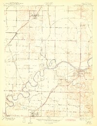
1943 Map of Lyons
USGS Topo · Published 1943About this map
White River oxbows and river-bottom wetlands dominate this mid-century portrait of the Greene and Daviess County border. The landscape is a network of drainage infrastructure and early transport, where the Pennsylvania and Chicago Milwaukee railroads intersect at Bushrod and Beehunter. These junctions supported a rural economy centered on settlements like Lyons, Newberry, and Elnora.
Find a feature on this map
43 named features on this map. Tap any name to fly to it.
Don’t see what you’re looking for? This feature index may not catch every label — zoom into the map to look around manually.
Map Details
Editions of this 1943 Lyons Map
2 editions found
Other maps of this area

1908 · Bloomfield
USGS Topo · 1:62,500

1938 · Switz City
USGS Topo · 1:24,000

1940 · Linton
USGS Topo · 1:24,000

1943 · Sandborn
USGS Topo · 1:24,000

1943 · Plainville
USGS Topo · 1:24,000

1943 · Epsom
USGS Topo · 1:24,000

1947 · Switz City
USGS Topo · 1:24,000

1947 · Linton
USGS Topo · 1:24,000

1950 · Switz City
USGS Topo · 1:24,000

1950 · Odon
USGS Topo · 1:24,000