
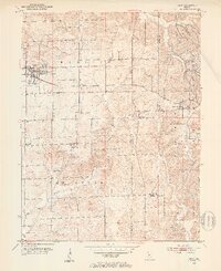
1950 Map of Odon
USGS Topo · Published 1953About this map
Odon serves as the primary hub of this southern Indiana landscape, which is marked by a transition from the structured grids of Madison township to the more varied terrain of Van Buren. In the mid-twentieth century, the Chicago Milwaukee St Paul and Pacific railroad cuts a straight line through the northern half of the map, passing just south of the town center. The landscape is a mix of small agricultural settlements and rural community centers like Raglesville and Bramble.
Find a feature on this map
27 named features on this map. Tap any name to fly to it.
Don’t see what you’re looking for? This feature index may not catch every label — zoom into the map to look around manually.
Map Details
Editions of this 1950 Odon Map
2 editions found
Other maps of this area

1943 · Lyons
USGS Topo · 1:24,000

1943 · Epsom
USGS Topo · 1:24,000

1944 · Montgomery
USGS Topo · 1:24,000

1950 · Shoals
USGS Topo · 1:24,000

1956 · Loogootee
USGS Topo · 1:24,000

1956 · Koleen
USGS Topo · 1:24,000

1956 · Indian Springs
USGS Topo · 1:24,000

1956 · Vincennes
USGS Topo · 1:250,000

1957 · Vincennes
USGS Topo · 1:250,000
1957 · Montgomery
USGS Topo · 1:24,000