Old Maps of Daviess County, Indiana
Explore 124 old maps of Daviess County, spanning from 1943 to today. These high-resolution historic maps reveal how streets, neighborhoods, landmarks, and natural features evolved over time — perfect for genealogy, metal detecting, research, and local history exploration.
What you can do with these maps:
- See how Daviess County changed over time: Compare historical maps to modern-day views to trace roads, homesites, rail lines & more.
- View detailed metadata: Each map includes creators, publishers, year, scale, and archive source.
- Overlay maps with satellite & LiDAR: Visualize the past alongside modern tools to explore terrain & human change.
- Trusted historical sources: Maps sourced from the USGS, Library of Congress, and other archives.
- Access maps your way: View online, download high-res files, or order prints for personal or research use.
Start exploring old maps of Daviess County to uncover forgotten places, hidden landmarks, and the deep history beneath your feet.
Daviess County, IN maps
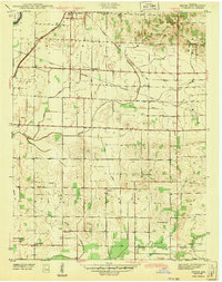
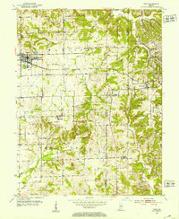
(124)- 1943 Map of Lyons
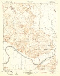
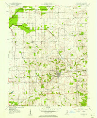
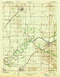 1943 Lyons1943 Print · USGSThe Greene and Daviess County borderlands in the 1940s are defined by the winding WHITE RIVER and a busy junction of coal-era railroads. Trace family roots at FRYE CEM or Old Slinkard Cem, and locate long-standing community centers like Mud Pike Ch and Elnora.2 unique versions available
 - 1943 Map of Sandborn
 1943 Sandborn1943 Print · USGSIn the early 1940s, this portion of Knox and Greene Counties was a busy corridor for coal mining and rail transport. Researchers can trace family history through local landmarks like Marco Cem, Pleasant Grove Ch, and the many Strip Mine works near Sponsler.2 unique versions available
 - 1943 Map of Bicknell
 1943 Bicknell1943 Print · USGSIn the early 1940s, this portion of Knox County was a hub of coal production and rail activity centered on the growing city of Bicknell. Genealogists and historians can locate numerous family burial sites like Walker Cem and trace the local mining economy through labels like Sunshine Mine and Panhandle Mine.2 unique versions available
 - 1943 Map of Plainville
 1943 Plainville1943 Print · USGSDaviess and Knox Counties appear here in the early 1940s, where the winding loops of the White River dominate the agricultural landscape. Genealogists and local historians can trace family locations near Plainville, Westphalia, or the historic Vincennes Tract boundary.2 unique versions available
 - 1943 Map of Epsom
 1943 Epsom1943 Print · USGSDaviess County during the early 1940s is captured here through its intricate ditch systems and crossing rail lines. Genealogists can locate family landmarks like Tolberts Chapel Cem and Cornettsville or trace the path of the New York Central.2 unique versions available
 - 1944 Map of Montgomery
 1944 Montgomery1944 Print · USGSDaviess County during the mid-1940s reveals a landscape defined by small-town life and the busy Baltimore and Ohio rail line. Researchers can locate family landmarks like St Peters Cem, Black Oak, and numerous rural schools including Ryan Sch.2 unique versions available
 - 1944 Map of Glendale
 1944 Glendale1944 Print · USGSDaviess County during the mid-1940s is defined by the winding East Fork White River and the rural crossroads of the Indiana countryside. Researchers can trace ancestral roots through local landmarks like Glencoe Cem, Pennyville, and a Coal Mine near High Rock.2 unique versions available
 - 1944 Map of Washington
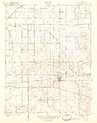
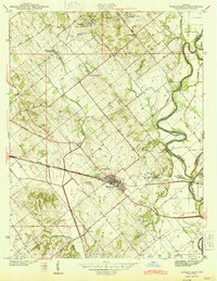
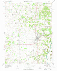
 1944 Washington1944 Print · USGSMid-century Washington and its neighboring Daviess County settlements are shown at their industrial peak as a central railroad crossroads. Genealogists and researchers can trace local families through many rural landmarks, including Hyatt Capehart P.O., St Johns Cem, and the Sugarland Sch.2 unique versions available
 - 1944 Map of Monroe City
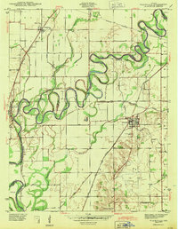
 1944 Monroe City1944 Print · USGSMonroe City and the surrounding Knox County bottomlands are captured here in the 1940s, just as the rural landscape was maturing. Researchers can trace family origins through numerous landmarks like Freeland Cemetery, Hamline Chapel, and Slickum School.2 unique versions available
 - 1944 Map of Wheatland
 1944 Wheatland1944 Print · USGSMid-century Knox County is defined by coal mining and rail transport at the height of the steam era. Genealogists and industrial historians can trace the Baltimore and Ohio Railroad through Wheatland and locate family-named sites like the Peacock Mine and Asbury Chapel.2 unique versions available
 - 1945 Map of Sandy Hook
 1945 Sandy Hook1945 Print · USGSDaviess County was a landscape of small schoolhouses and river junctions during the 1940s. Genealogists and local historians can trace family locations near Union Cemetery or locate old community centers like Sandy Hook and Needmore Sch.2 unique versions available
 - 1946 Map of Jasper
 1946 Jasper1946 Print · USGSMid-century Dubois County comes alive in this survey of the Jasper area during the years following the war. Genealogists can locate family landmarks like Sherritt Cem, old rural schoolhouses such as Hope Sch, and the rail-side industry of the Southern line.2 unique versions available
 - 1950 Map of Odon, 1953 Print
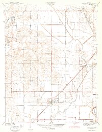
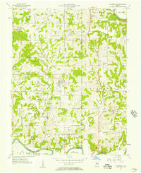
 1950 Odon1953 Print · USGSDaviess and Martin counties are captured here in the early fifties, showing a region of quiet agricultural towns and developing industry. Researchers can find many family landmarks, including Walnut Hill Cem, Union Chapel, and the settlement of Raglesville.2 unique versions available
 - 1956 Map of Alfordsville, 1957 Print
 1956 Alfordsville1957 Print · USGSDaviess and Dubois counties come alive in the mid-1950s as a landscape of surface mines and river-bottom settlements. Genealogists and historians can trace family locations near Alfordsville, Truelove Ch, and the old river crossing at Portersville.2 unique versions available
 - 1956 Map of Loogootee, 1957 Print
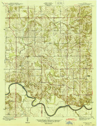
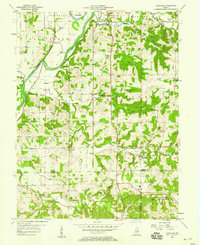
 1956 Loogootee1957 Print · USGSLoogootee and Cannelburg sit at the heart of this mid-fifties survey of the Daviess and Martin County border. Researchers can trace ancestral roots at St Johns Cemetery, locate the rail-side industry of a Strip Mine, or follow the banks of the East Fork White River.2 unique versions available
 - 1956 Map of Vincennes, 1967 Print
 1956 Vincennes1967 Print · USGSSouthern Indiana and the Illinois borderlands are captured here in the mid-fifties, showing the region's dense network of river towns and rail lines. Researchers can trace historic river crossings along the Wabash River or locate landmarks like Wyandotte Cave and Lincoln State Park.4 unique versions available
 - 1957 Map of Vincennes
 1957 Vincennes1957 Print · USGSSouthwest Indiana and the Illinois borderlands come alive in the late 1950s, a period of heavy rail traffic and expanding state forests. Genealogists and historians can trace the riverfronts and rail lines of Vincennes, New Harmony, and the vast Crane Naval Ammunition Depot.
 - 1957 Map of Plainville, 1958 Print
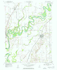 1957 Plainville1958 Print · USGSDaviess and Knox counties are captured here in the late fifties, showcasing the intricate meanders of the White River. Genealogists and local historians can trace the foundations of Plainville and Westphalia, locating old Oil Wells, Salem Ch, and the Plainville Cem.3 unique versions available
 - 1957 Map of Montgomery, 1958 Print
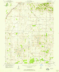
 1957 Montgomery1958 Print · USGSDaviess County during the late 1950s shows a landscape of small railway towns and scattered oil extraction sites. Genealogists can locate family landmarks like Stoll Cem, Antioch Ch, and the rural Parsons Sch along the Baltimore and Ohio line.
 - 1957 Map of Scotland, 1958 Print
 1957 Scotland1958 Print · USGSGreene County townships meet the northern edge of a major naval installation in the late fifties. Genealogists can trace family roots through numerous landmarks like Simpson Chapel, Hicks Cem, and the old settlement of Mineral City.2 unique versions available
 - 1957 Map of Washington, 1958 Print
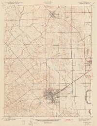
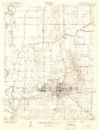
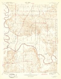
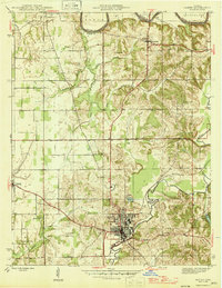
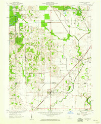
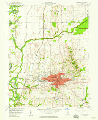 1957 Washington1958 Print · USGSDaviess County's rail and river economy is on full display during the late 1950s, centered on the bustling hub of WASHINGTON. Researchers can trace old family sites and civic roots at St Johns Cem, Sugarland Ch, and the BALTIMORE AND OHIO RAILROAD corridor.4 unique versions available
 - 1957 Map of Epsom, 1958 Print
 1957 Epsom1958 Print · USGSDaviess County was undergoing an industrial transition in the late fifties as coal mining and oil production moved into its rural townships. Genealogists and historians can trace family locations through Epsom, Cornettsville, and remote sites like Ochiltree Cem or Bethel Ch.
 - 1958 Map of Vincennes
 1958 Vincennes1958 Print · USGSSouthern Indiana and the Illinois borderlands are captured during a mid-century period of heavy rail traffic and military activity. Researchers can trace the sprawling bounds of the Crane Naval Ammunition Depot or locate historic settlements like New Harmony and French Lick.2 unique versions available
 - 1958 Map of Monroe City, 1959 Print
 1958 Monroe City1959 Print · USGSThe White River valley and the Beech Hills are captured in the late 1950s, showing a landscape shaped by coal, oil, and the railroad. Genealogists can trace family landmarks like Hamline Chapel, Reels Chapel, and the settlement of Monroe City.2 unique versions available
 - 1958 Map of Sandborn, 1959 Print
 1958 Sandborn1959 Print · USGSThe Knox and Greene county borderlands come into focus in the late fifties, showing a rural landscape shaped by the White River and a network of drainage ditches. Researchers can trace historic family locations at Sandborn Cem and Marco, or locate the path of the Indian Treaty Boundary.2 unique versions available
Showing maps 1-25 of 124
Top cities of Daviess County
- Washington historical maps
- Odon historical maps
- Elnora historical maps
- Plainville historical maps
- Montgomery historical maps
- Cannelburg historical maps
See more
Frequently asked questions
- What are the different types of historical maps available for Daviess County?
- What is the oldest map of Daviess County?
- Where can I purchase historical maps of Daviess County for my home or office?
- Where can I download high-res historical maps of Daviess County?
- Are there historical topographic maps available for Daviess County?
- Is there historical aerial imagery available for Daviess County?
- Where are historical maps of Daviess County sourced from?