2020s Maps of Daviess County, Indiana
Explore 16 historic maps of Daviess County from the 2020s. These maps offer a rare glimpse into what life looked like during the 2020s — showing old roads, neighborhoods, homes, and landmarks that have changed or disappeared over time.
Whether you're researching your family's past, planning a metal detecting trip, or studying how Daviess County's landscape evolved across the 2020s, these high-resolution maps are a powerful tool for exploring the history of this region.
- Focus on a specific era: All maps on this page are from the 2020s, giving you a focused view of this time period.
- See what’s changed: Compare century-old streets, trails, and buildings to today's modern landscape using overlays and satellite layers.
- Research with precision: Use these maps for genealogy, historical research, land use analysis, or educational projects.
- View, download, or print: Maps are fully viewable online in high resolution, and can be downloaded or printed for your own records.
Start exploring Daviess County's history through authentic maps from the 2020s. This is your window into the past.
Daviess County, IN maps
(16)- 2022 Map of Lyons, 2022 Print
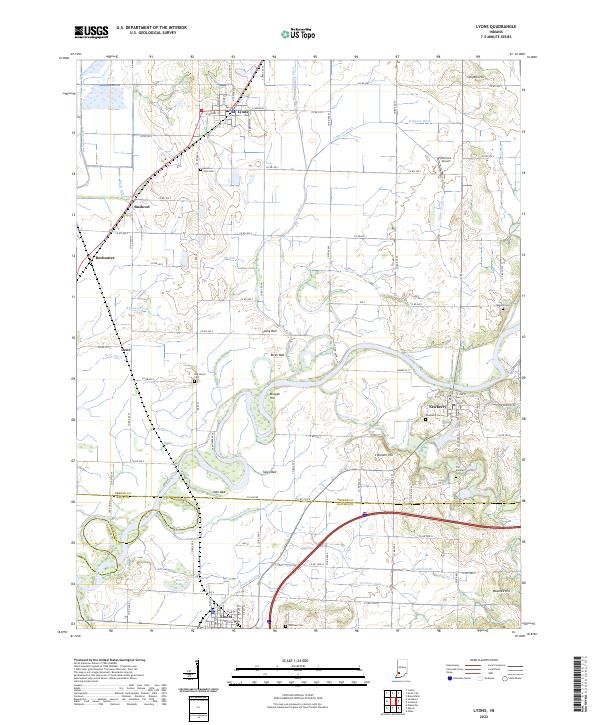 2022 Lyons2022 Print · USGSIndiana's fertile river lowlands are meticulously detailed in this recent survey of the Greene, Knox, and Daviess county borders. Genealogists can locate family burial sites at Mount Zion Cem and Old Slinkard Cem, or trace the rural landscape around Newberry and Lyons.
 - 2022 Map of Montgomery, 2022 Print
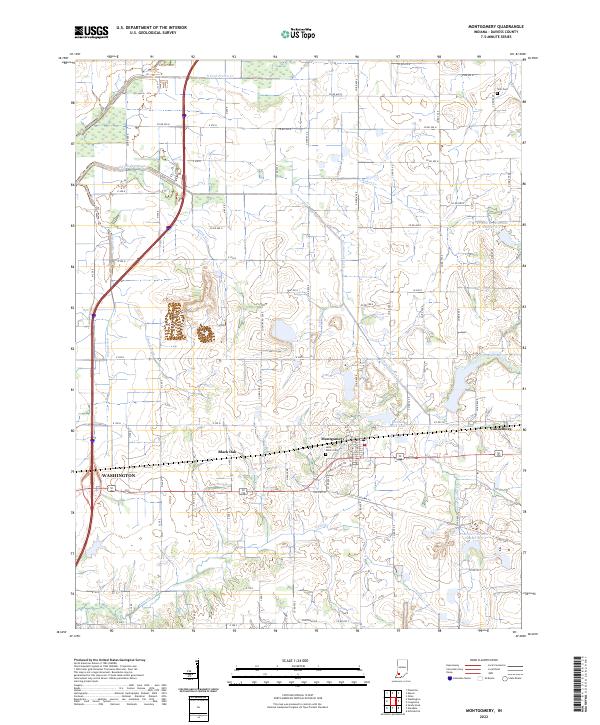 2022 Montgomery2022 Print · USGSDaviess County farmland and small-town centers appear in detail in this contemporary survey of southwestern Indiana. Genealogists and local historians can trace family sites at Saint Peters Cem or explore the settlements of Montgomery and Cannelburg.
 - 2022 Map of Plainville, 2022 Print
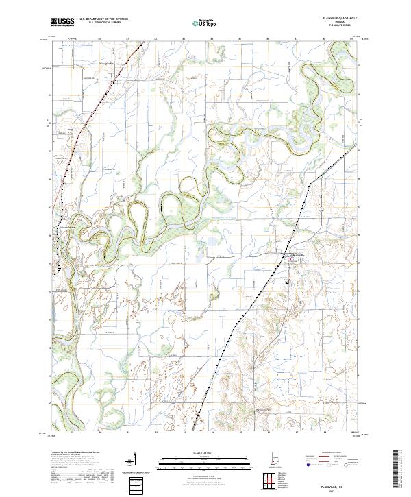 2022 Plainville2022 Print · USGSSouthern Indiana bottomlands along the White River come into focus in this recent survey of the border between Daviess and Knox counties. Researchers can trace the drainage of the fertile valley through features like Killion Canal, Plainville Cemetery, and Harbstreit Hill.
 - 2022 Map of Sandborn, 2022 Print
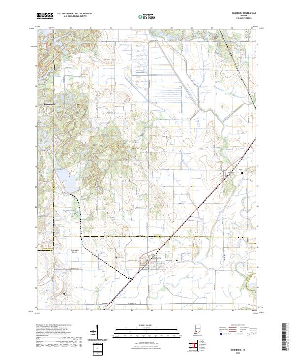 2022 Sandborn2022 Print · USGSIndiana's farm country and the intricate drainage of the Wabash River basin are captured here in the early twenty-first century. Genealogists and local historians can locate Sandborn Cem, trace the rail-adjacent town of Marco, or explore the Cane Green Bottom wetlands.
 - 2022 Map of Wheatland, 2022 Print
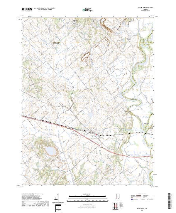 2022 Wheatland2022 Print · USGSWheatland and the surrounding Knox County bottomlands are mapped here during the early twenty-first century as the White River maintains its winding course. Researchers can trace the heritage of local family names and small communities through sites like Indian Creek Settlement, Asbury Chapel Cem, and Ghost Hollow.
 - 2022 Map of Glendale, 2022 Print
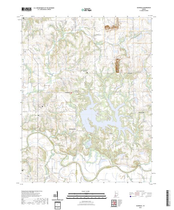 2022 Glendale2022 Print · USGSDaviess County's rural landscape is captured here in the early twenty-first century, showing the enduring layout of river-border settlements. Genealogists can locate family burial grounds at East Union Cem and Ebenezer Cem or trace the old roads connecting Hudsonville and Waco.
 - 2022 Map of Bicknell, 2022 Print
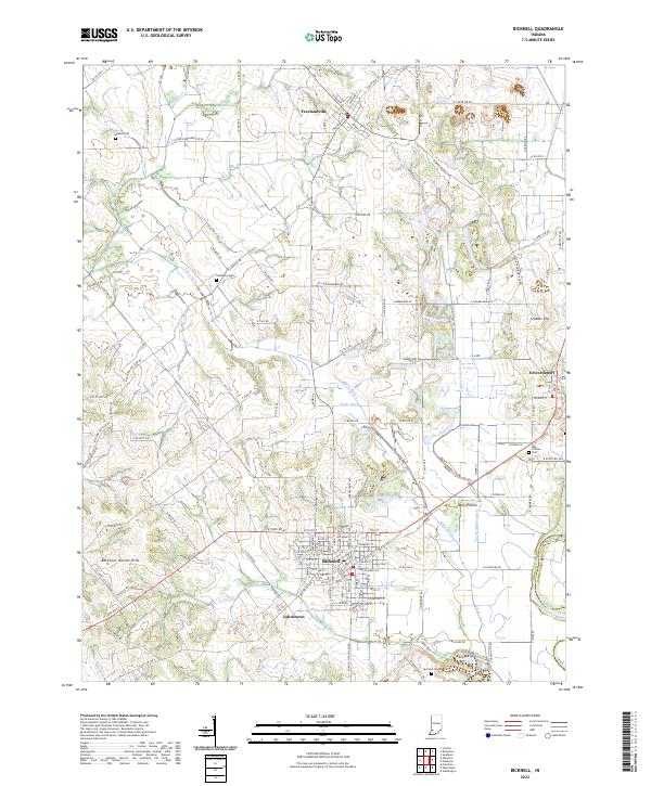 2022 Bicknell2022 Print · USGSThe northern reaches of Knox County come into focus in this contemporary survey of the Bicknell region. Family researchers can trace burial sites at Walker Cem and Odd Fellows Cem, or locate landmarks like Barefoot Nation Hills and the White River.
 - 2022 Map of Sandy Hook, 2022 Print
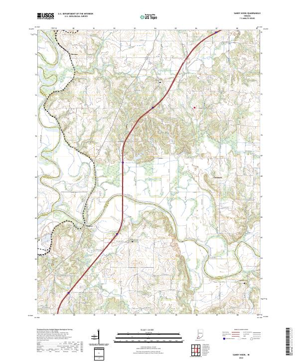 2022 Sandy Hook2022 Print · USGSSouthwestern Indiana's river junctions and rural hamlets are documented in this recent survey of the White River valley. Genealogists and local researchers can locate family sites near Rogers, Cumback, and several rural burial grounds like Arnold Cem and Bethel Cem.
 - 2022 Map of Washington, 2022 Print
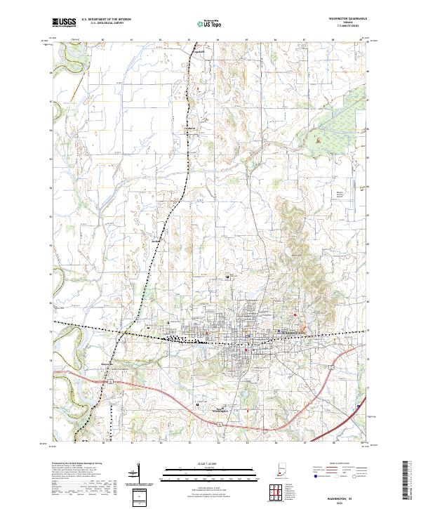 2022 Washington2022 Print · USGSDaviess County during the early twenty-first century reveals a landscape defined by the intersection of the Washington city grid and the White River basin. Researchers can trace family history at Hawkins Cem or Colbert Cem and locate rural landmarks like Sefert Hill.
 - 2022 Map of Monroe City, 2022 Print
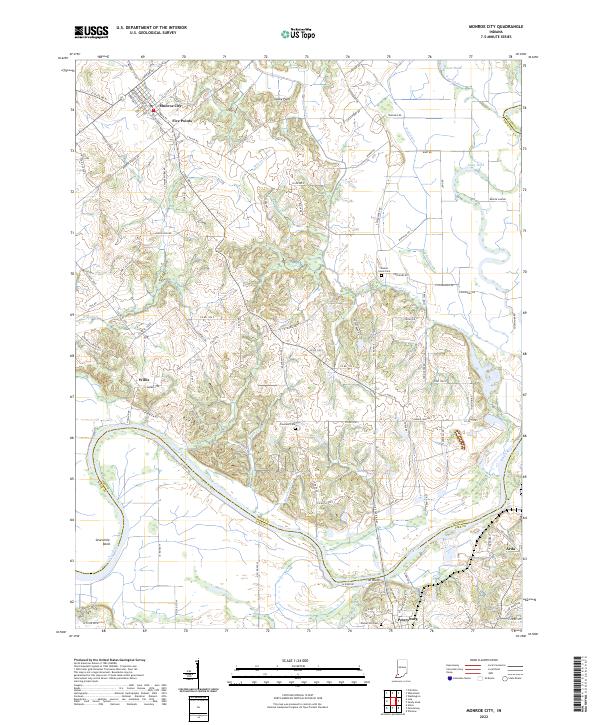 2022 Monroe City2022 Print · USGSMonroe City and the winding White River valley are documented here in the early 2020s, showing a landscape shaped by water and agriculture. Genealogists and local researchers can locate quiet landmarks like Walnut Grove Cem, The Bluffs, and the small settlement of Willis.
 - 2022 Map of Jasper, 2022 Print
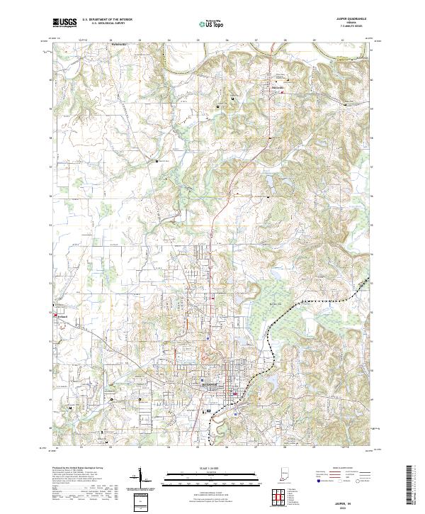 2022 Jasper2022 Print · USGSJasper and its neighboring communities in Dubois County appear here during the early twenty-first century as the region maintains its river-town character. Local researchers can locate numerous family burial grounds like Sherritt Cem and Kelso Cem or trace the path of the Patoka River.
 - 2022 Map of Odon, 2022 Print
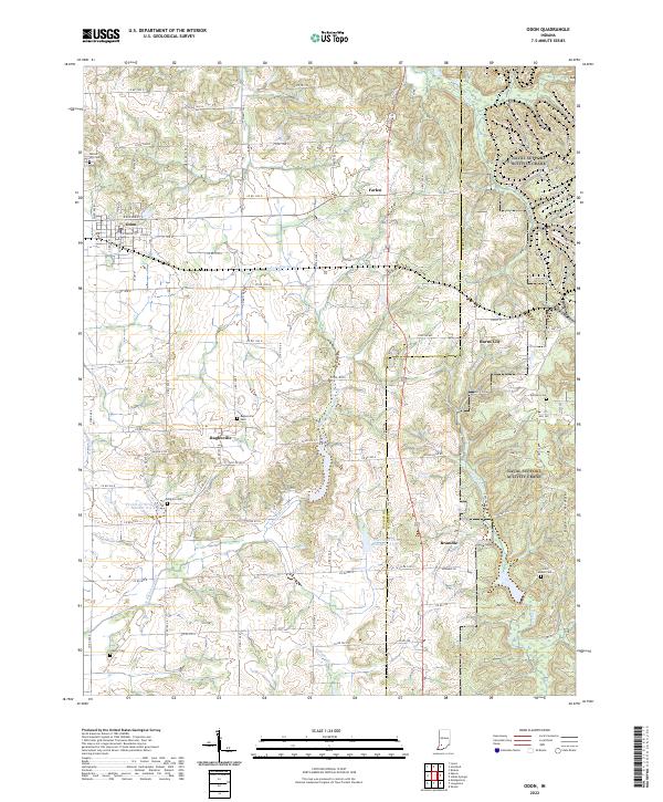 2022 Odon2022 Print · USGSDaviess and Martin Counties are shown in the early 2020s, documenting a landscape defined by traditional farming and rural hamlets. Genealogists and local historians can trace family roots through sites like Raglesville Cem, Kilgore Cem, and the small settlement of Bramble.
 - 2022 Map of Alfordsville, 2022 Print
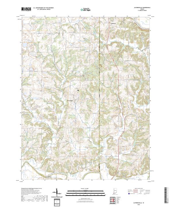 2022 Alfordsville2022 Print · USGSDaviess County farmland meets the winding East Fork White River in the early 2020s. Genealogists and local historians can trace family-named landmarks and rural routes, from the Alfordsville Cem to the high ground of Knob Hill and Hopper Hill.
 - 2022 Map of Epsom, 2022 Print
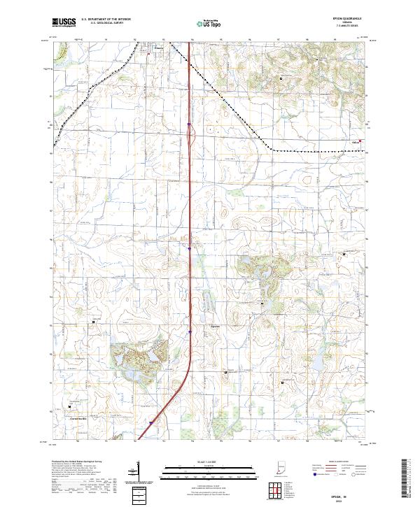 2022 Epsom2022 Print · USGSDaviess County farmland in the early 2020s is shaped by a complex system of drainage ditches and rural settlements. Researchers can locate many local burial sites, including Talbotts Chapel Cem and Cornettsville Cem, along with the crossroads of Epsom.
 - 2022 Map of Loogootee, 2022 Print
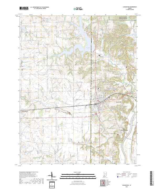 2022 Loogootee2022 Print · USGSLoogootee and its surrounding rural townships are mapped here in the early 2020s, showing the modern layout of the Martin County seat. Genealogists can locate several historic burial sites, including Goodwill Cem and Saint Johns Cem, alongside the small communities of Cannelburg and Mount Pleasant.
 - 2022 Map of Scotland, 2022 Print
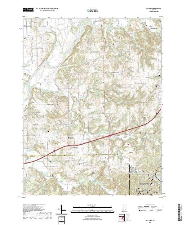 2022 Scotland2022 Print · USGSSouthern Indiana ridge country comes to life in this survey of Greene County and its neighbors. Genealogists and historians can trace family roots at Smith Bethel Cemetery, Jolliff Rocks, and the rural settlement of Scotland.
End of results
Showing maps 1-16 of 16
Top cities of Daviess County
- Washington historical maps
- Odon historical maps
- Elnora historical maps
- Plainville historical maps
- Montgomery historical maps
- Cannelburg historical maps
See more
Frequently asked questions
- What are the different types of historical maps available for Daviess County?
- What is the oldest map of Daviess County?
- Where can I purchase historical maps of Daviess County for my home or office?
- Where can I download high-res historical maps of Daviess County?
- Are there historical topographic maps available for Daviess County?
- Is there historical aerial imagery available for Daviess County?
- Where are historical maps of Daviess County sourced from?