
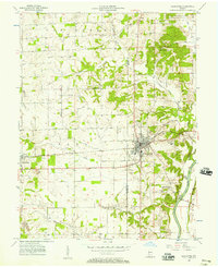
1956 Map of Loogootee
USGS Topo · Published 1957About this map
The town of Loogootee serves as the central hub of this 1950s survey, situated where the Baltimore and Ohio railroad corridor cuts across the boundary of Daviess and Martin County. The landscape reflects a mix of traditional agriculture and burgeoning heavy industry, evidenced by the extensive strip mine operations and scattered oil wells found near Cannelburg. To the east, the terrain becomes more varied as it approaches the East Fork White River, where Houghton Bridge and the Pumping Station mark the river economy.
Find a feature on this map
38 named features on this map. Tap any name to fly to it.
Don’t see what you’re looking for? This feature index may not catch every label — zoom into the map to look around manually.
Map Details
Editions of this 1956 Loogootee Map
2 editions found
Other maps of this area

1943 · Epsom
USGS Topo · 1:24,000

1944 · Montgomery
USGS Topo · 1:24,000

1944 · Glendale
USGS Topo · 1:24,000

1950 · Shoals
USGS Topo · 1:24,000

1950 · Odon
USGS Topo · 1:24,000

1956 · Alfordsville
USGS Topo · 1:24,000

1956 · Rusk
USGS Topo · 1:24,000

1956 · Indian Springs
USGS Topo · 1:24,000

1956 · Vincennes
USGS Topo · 1:250,000

1957 · Vincennes
USGS Topo · 1:250,000