
Loading...
Loading map...2023 Map of Bloomville
USGS Topo · Published 2023About this map
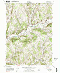
The West Branch Delaware River carves a deep valley through the high ridges of Delaware County, centering on the settlement of Bloomville. This modern topographic study reveals a landscape where steep hillsides and narrow river bottoms dictate the placement of local infrastructure, from the winding Co HWY 33 to family-named landmarks like Boomhower Hill.
Find a feature on this map
74 named features on this map. Tap any name to fly to it.
Don’t see what you’re looking for? This feature index may not catch every label — zoom into the map to look around manually.
Map Details
Date Portrayed2023
Date Published2023
PublisherU.S. Geological Survey
Map TypeTopographic
Scale1:24000
Physical Dimensions24 x 29 inches
Editions of this 2023 Bloomville Map
This is the sole edition of this map. No revisions or reprints were ever made.
Historical Maps of Kortright Through Time
Featured Locations
Source Details
SourceU.S. Geological Survey
CopyrightPublic Domain