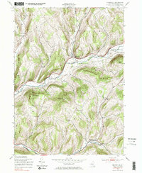
1943 Map of Bloomville
USGS Topo · Published 1985About this map
The West Branch Delaware River carves through this upland portion of Delaware County, where the settlement of Bloomville sits at the junction of the New York Central Road and Wright Brook. The landscape in the mid-1940s is defined by a dense network of district schools and family cemeteries that speak to a distributed dairy-farming economy. Researchers can locate specific schoolhouses such as Federal Hill Sch, Glen Burnie Sch, and Miller Ave Sch, which served the rural families living along the steep ridges of Bramley Mtn and Boomhower Hill. In the southern portion of the quadrangle, Bovina Center marks the valley of the Little Delaware River, connected to the northern reaches by the high-elevation Bovina Hill Road. The prominence of named brooks like Kidd Brook and Kiff Brook underscores the importance of water access for the various townships including Meredith and Kortright.
Find a feature on this map
39 named features on this map. Tap any name to fly to it.
Don’t see what you’re looking for? This feature index may not catch every label — zoom into the map to look around manually.
Map Details
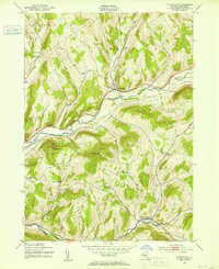
Editions of this 1943 Bloomville Map
Other maps of this area

1901 · Margaretville
USGS Topo · 1:62,500

1904 · Hobart
USGS Topo · 1:62,500

1904 · Margaretville
USGS Topo · 1:62,500

1909 · Delhi
USGS Topo · 1:62,500

1911 · Delhi
USGS Topo · 1:62,500

1922 · Andes
USGS Topo · 1:62,500

1924 · Andes
USGS Topo · 1:62,500

1943 · Delhi
USGS Topo · 1:24,000

1943 · Bloomville
USGS Topo · 1:24,000
1943 · West Davenport
USGS Topo · 1:24,000