2022 Map of Blue
USGS Topo · Published 2022About this map
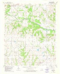
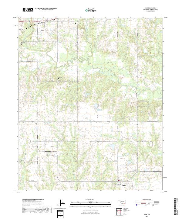
The Blue River meanders through the heart of Bryan County, Oklahoma, defining a landscape of small agricultural settlements and family burial grounds. This 2022 survey documents the rural character of communities like Blue, Utica, and Albany, connected by a network of section-line roads such as Five Doe Rd and Jim Mac Rd. Genealogists will find several notable local sites, including the Old Philadelphia Cem and Burris Cem. The terrain is marked by numerous small lakes and creeks, including McGee Lake Number 1 and McGee Lake Number 2, which suggest a topography shaped by both natural drainage and land management. The presence of Old Hwy 70 provides a clear link to the area's historic transportation corridor, contrasting with more modern rural routes like McKennon Rd.
Find a feature on this map
55 named features on this map. Tap any name to fly to it.
Don’t see what you’re looking for? This feature index may not catch every label — zoom into the map to look around manually.
Map Details
Editions of this 2022 Blue Map
This is the sole edition of this map. No revisions or reprints were ever made.