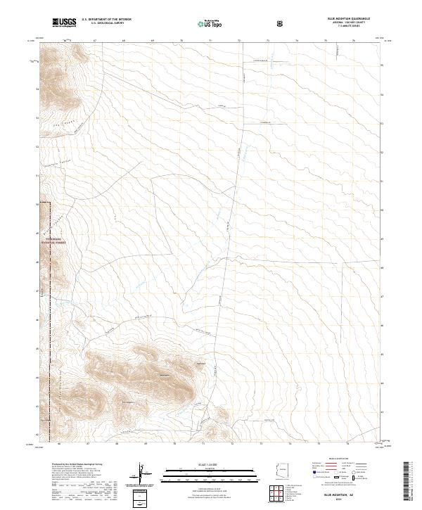
2021 Map of Blue Mountain
USGS Topo · Published 2021About this map
The Chiricahua Mountains dominate the southwestern portion of this Cochise County landscape, where the high peak of Blue Mtn rises above sharp local landmarks like The Nippers and Haystack. Much of the western terrain is protected within the Coronado National Forest, a region defined by steep drainages including Fox Canyon, Triangle Canyon, and Brushy Canyon. This 2021 survey illustrates a sparse network of ranch and forest roads, such as White Tail Canyon Rd and S Noland Rd, which navigate the transition from the high peaks to the arid basin floor.
Find a feature on this map
31 named features on this map. Tap any name to fly to it.
Don’t see what you’re looking for? This feature index may not catch every label — zoom into the map to look around manually.
Map Details
Editions of this 2021 Blue Mountain Map
This is the sole edition of this map. No revisions or reprints were ever made.
Other maps of this area

1917 · San Simon
USGS Topo · 1:125,000

1917 · Chiricahua
USGS Topo · 1:125,000

1919 · Chiricahua
USGS Topo · 1:125,000

1926 · Cochise Head
USGS Topo · 1:62,500

1926 · Rodeo
USGS Topo · 1:62,500

1926 · Rucker
USGS Topo · 1:62,500

1928 · Chenoweth
USGS Topo · 1:62,500

1950 · Cochise Head
USGS Topo · 1:62,500

1950 · Vanar
USGS Topo · 1:62,500

1951 · Vanar
USGS Topo · 1:62,500