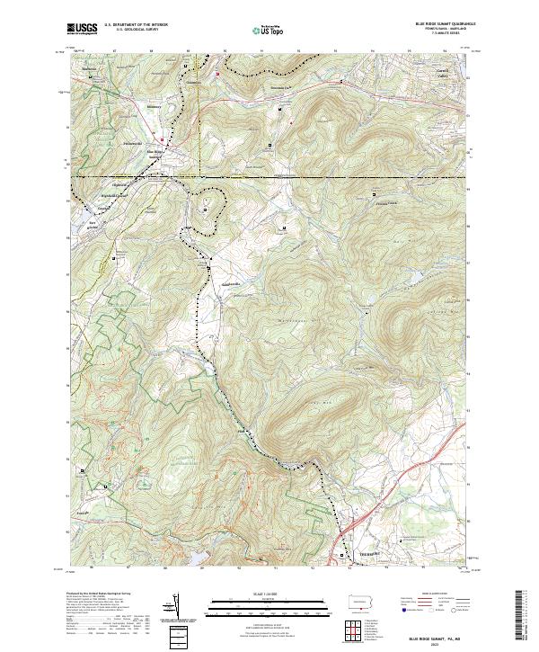
2023 Map of Blue Ridge Summit
USGS Topo · Published 2023About this map
Catoctin Mountain Park and the Appalachian National Scenic Trail dominate this landscape where the Pennsylvania and Maryland border creates a complex patchwork of mountain ridges and valleys. The rugged spine of South Mountain is marked by landmarks such as Monterey Peak and Buzzards Roost, while the valley floors support long-established settlements like Blue Ridge Summit, Sabillasville, and Cascade. The presence of Fort Ritchie and various mountain retreats reflects the area's legacy as both a strategic military location and a seasonal destination.
Find a feature on this map
175 named features on this map. Tap any name to fly to it.
Don’t see what you’re looking for? This feature index may not catch every label — zoom into the map to look around manually.
Map Details
Editions of this 2023 Blue Ridge Summit Map
This is the sole edition of this map. No revisions or reprints were ever made.
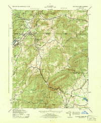
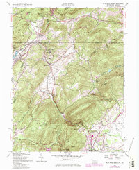
Historical Maps of Foxville Through Time
3 maps found
Featured Locations
- Thurmont, MD
- Sabillasville, MD
- Highfield-Cascade, MD
- Carroll Valley, PA
- Blue Ridge Summit, Washington Township