2023 Map of Bluebell
USGS Topo · Published 2023About this map
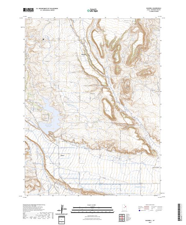
The agrarian settlements of Bluebell and Upalco anchor this portrait of Duchesne County, Utah, where a sophisticated network of irrigation canals transforms the arid landscape. The map reveals the intricate engineering required to water the basin, featuring the Bluebell Lateral, Lake Fork Canal, and Leland Canal, which draw from the Lake Fork River and Big Sand Wash Reservoir. These waterways are the lifeblood of the valley, supporting homesteads situated between the high topography of Monarch Ridge and Pine Ridge. Local history is preserved at the Bluebell Cem and Upalco Cem, while the rugged natural breaks of Gundy Hollow and the prominent Flat Top define the eastern terrain. The survey captures a high-desert environment defined by its water management and the enduring continuity of its rural communities.
Find a feature on this map
42 named features on this map. Tap any name to fly to it.
Don’t see what you’re looking for? This feature index may not catch every label — zoom into the map to look around manually.
Map Details
Editions of this 2023 Bluebell Map
This is the sole edition of this map. No revisions or reprints were ever made.