Loading...
Loading map...2024 Map of Bluford
USGS Topo · Published 2024About this map
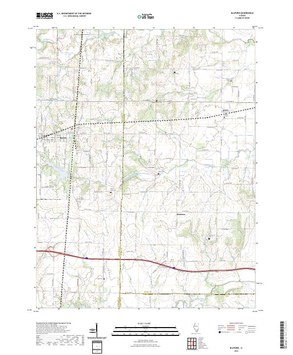
Bluford serves as a primary hub in this Jefferson County landscape, where the intersection of local routes like Co Rd 1400 N and Co Rd 2200 E defines the settlement's layout. The map documents a rural transition where the villages of Keenes and Middleton anchor the eastern and southern reaches, respectively. A distinct cluster of family and community burial grounds, including Bruce Cem, Egbert Cem, and Farnsworth Cem, provides critical data for genealogists tracing local lineage.
Find a feature on this map
95 named features on this map. Tap any name to fly to it.
Don’t see what you’re looking for? This feature index may not catch every label — zoom into the map to look around manually.
Map Details
Date Portrayed2024
Date Published2024
PublisherU.S. Geological Survey
Map TypeTopographic
Scale1:24000
Physical Dimensions24 x 29 inches
Editions of this 2024 Bluford Map
This is the sole edition of this map. No revisions or reprints were ever made.
Historical Maps of Markham City Through Time
Featured Locations
Source Details
SourceU.S. Geological Survey
CopyrightPublic Domain