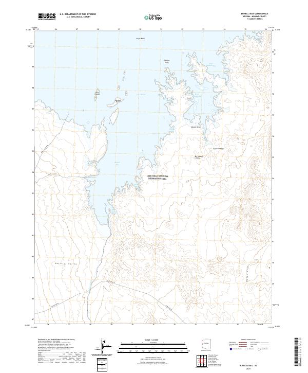
2021 Map of Bonelli Bay
USGS Topo · Published 2021About this map
Lake Mead National Recreation Area dominates this Mohave County landscape, where the waters of Lake Mead meet the northern edge of the Mojave Desert. The map reveals a complex shoreline defined by significant inlets like Bonelli Bay and Virgin Basin, alongside smaller recesses such as Secret Cove and Alkali Spring Cove. The arid geography is further shaped by geological formations like the Gypsum Reefs, Big Gypsum Ledges, and the White Hills to the southeast.
Find a feature on this map
27 named features on this map. Tap any name to fly to it.
Don’t see what you’re looking for? This feature index may not catch every label — zoom into the map to look around manually.
Map Details
Editions of this 2021 Bonelli Bay Map
This is the sole edition of this map. No revisions or reprints were ever made.
Other maps of this area

1886 · Camp Mohave
USGS Topo · 1:250,000

1886 · Saint Thomas
USGS Topo · 1:250,000

1892 · Camp Mohave
USGS Topo · 1:250,000

1893 · Saint Thomas
USGS Topo · 1:250,000

1926 · Nelson
USGS Topo · 1:96,000

1926 · Bonelli
USGS Topo · 1:96,000

1926 · Boulder Canyon
USGS Topo · 1:96,000

1942 · Camp Mohave
USGS Topo · 1:250,000

1947 · Kingman
USGS Topo · 1:250,000

1948 · Kingman
USGS Topo · 1:250,000