2022 Map of Bourbon
USGS Topo · Published 2022About this map
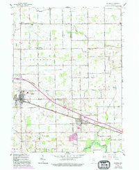
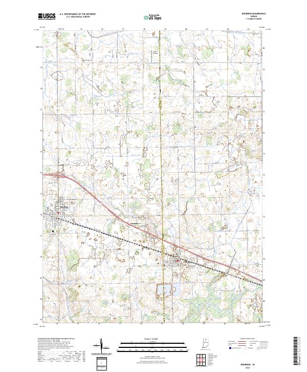
Bourbon and Etna Green anchor this portion of the Northern Indiana agricultural landscape, where the drainage patterns of the Tippecanoe River and a dense network of engineered waterways like Danner Ditch and Lemer-Berger Ditch dictate the rural layout. The map documents the boundary line between Marshall Co and Kosciusko Co, a divide that runs through the center of the survey area. Local heritage is preserved in several burial grounds, including Sandridge Cem to the north and the twin Etna Green West Cem and Etna Green East Cem on the outskirts of the village. Aviation and recreation interests are represented by Arrowhead Farm Airport and Rust's Landing, showing how the land has been adapted for modern utility alongside traditional farming. The rectlinear road grid, punctuated by routes like Main ST and Co Line RD, illustrates the systematic organization of the countryside into productive agricultural blocks.
Find a feature on this map
93 named features on this map. Tap any name to fly to it.
Don’t see what you’re looking for? This feature index may not catch every label — zoom into the map to look around manually.
Map Details
Editions of this 2022 Bourbon Map
This is the sole edition of this map. No revisions or reprints were ever made.