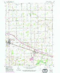
1958 Map of Bourbon
USGS Topo · Published 1994About this map
The town of Bourbon serves as a primary hub in this Marshall County landscape, where the local Fairgrounds and various civic landmarks reflect the agricultural and community focus of the late 1950s. The town's layout is centered around the intersection of historical transport routes like the Lincoln Highway, which connects it southeast toward Etna Green. This neighboring settlement in Kosciusko County is home to the Township Sch and the Etna Green Cem, markers of local heritage situated along the rail lines.
Find a feature on this map
55 named features on this map. Tap any name to fly to it.
Don’t see what you’re looking for? This feature index may not catch every label — zoom into the map to look around manually.
Map Details
Editions of this 1958 Bourbon Map
4 editions found
Other maps of this area

1953 · Fort Wayne
USGS Topo · 1:250,000

1953 · Chicago
USGS Topo · 1:250,000

1956 · Fort Wayne
USGS Topo · 1:250,000

1957 · Chicago
USGS Topo · 1:250,000

1957 · Inwood
USGS Topo · 1:24,000

1958 · Bremen
USGS Topo · 1:24,000

1958 · Nappanee West
USGS Topo · 1:24,000

1958 · Nappanee East
USGS Topo · 1:24,000

1958 · Bourbon
USGS Topo · 1:24,000

1959 · Atwood
USGS Topo · 1:24,000