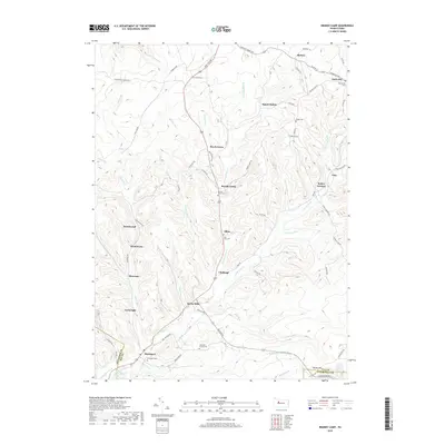
2019 Map of Brandy Camp
USGS Topo · Published 2019About this map
Brandy Camp and the surrounding Elk County settlements are defined by a network of rural hamlets and cemeteries concentrated along the valley of Brandy Camp Cr. This landscape reflects a tradition of small, distinct communities including Beech Grove, Elbon, and Challenge, many of which developed around local resource extraction and agriculture. The terrain transitions into the steep slopes of Boone Mtn to the southeast, while the southern reach of the quadrangle follows the winding path of Little Toby Cr near Brockport. Genealogists will find a high density of burial sites preserved here, such as the Mountain Church Cem and Holy Cross Cem, which serve as lasting markers of the families who settled this portion of the Pennsylvania wilds.
Find a feature on this map
77 named features on this map. Tap any name to fly to it.
Don’t see what you’re looking for? This feature index may not catch every label — zoom into the map to look around manually.
Map Details
Editions of this 2019 Brandy Camp Map
This is the sole edition of this map. No revisions or reprints were ever made.
Other maps of this area

1922 · Du Bois
USGS Topo · 1:62,500

1924 · Du Bois
USGS Topo · 1:62,500

1929 · Penfield
USGS Topo · 1:62,500

1932 · Penfield
USGS Topo · 1:62,500

1940 · Hallton
USGS Topo · 1:48,000

1941 · Ridgway
USGS Topo · 1:62,500

1943 · Hallton
USGS Topo · 1:62,500

1944 · Du Bois
USGS Topo · 1:62,500

1944 · Ridgway
USGS Topo · 1:62,500

1957 · Warren
USGS Topo · 1:250,000
Featured Places
- Challenge, Horton Township
- Drummond, Horton Township
- Kylers Corners, Fox Township
- Fox Township, PA
- Brandy Camp, Horton Township