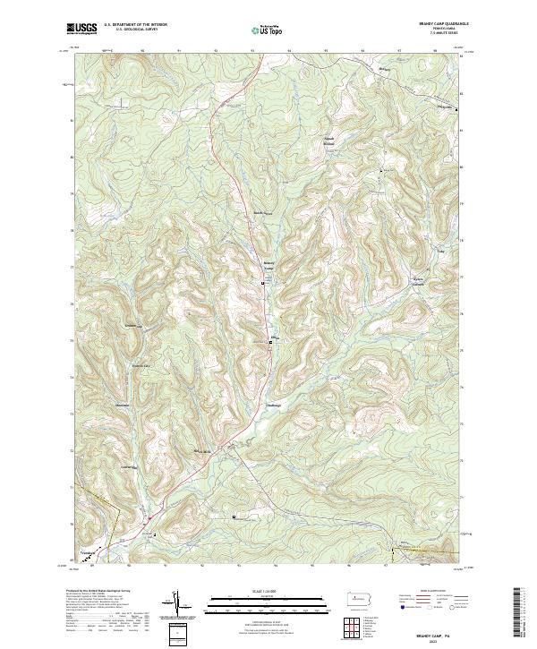
2023 Map of Brandy Camp
USGS Topo · Published 2023About this map
Brandy Camp and its neighboring hamlets along the winding valley of Brandy Camp Creek form the heart of this Pennsylvania landscape. The map reveals a dense network of small communities and family burial grounds, including Holy Cross Cem and Brandy Camp Cem, that reflect the deep-rooted settlement patterns of the region. Many of these places, like Beech Grove, Elbon, and Challenge, are situated along the primary north-south corridors, while others such as Horton City and Shawmut occupy the higher ground to the west.
Find a feature on this map
73 named features on this map. Tap any name to fly to it.
Don’t see what you’re looking for? This feature index may not catch every label — zoom into the map to look around manually.
Map Details
Editions of this 2023 Brandy Camp Map
This is the sole edition of this map. No revisions or reprints were ever made.
Other maps of this area

1922 · Du Bois
USGS Topo · 1:62,500

1924 · Du Bois
USGS Topo · 1:62,500

1929 · Penfield
USGS Topo · 1:62,500

1932 · Penfield
USGS Topo · 1:62,500

1940 · Hallton
USGS Topo · 1:48,000

1941 · Ridgway
USGS Topo · 1:62,500

1943 · Hallton
USGS Topo · 1:62,500

1944 · Du Bois
USGS Topo · 1:62,500

1944 · Ridgway
USGS Topo · 1:62,500

1957 · Warren
USGS Topo · 1:250,000
Featured Places
- Horton Township, PA
- Ridgway Township, PA
- Snyder Township, PA
- Beech Grove, Horton Township
- Cartwright, Horton Township