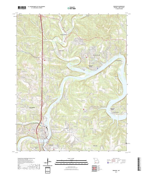
2021 Map of Branson
USGS Topo · Published 2021About this map
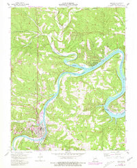
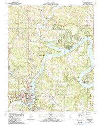
Branson and Hollister anchor this Taney County landscape at a point of significant recreational and residential expansion along the waterways. The area is defined by the winding course of Bull Creek, which feeds into the larger system near Rockaway Beach and Ozark Beach. This topography reflects the transition from traditional Ozark settlements like Walnut Shade to modern leisure-focused communities such as Merriam Woods and Chula Vista. Local aviation is represented by the M Graham Clark Downtown Airport, situated on the southern bank of the main waterway.
Find a feature on this map
43 named features on this map. Tap any name to fly to it.
Don’t see what you’re looking for? This feature index may not catch every label — zoom into the map to look around manually.
Map Details
Editions of this 2021 Branson Map
This is the sole edition of this map. No revisions or reprints were ever made.