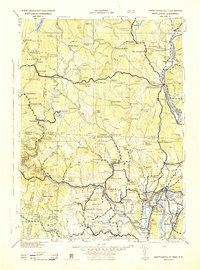
1943 Map of Brattleboro
USGS Topo · Published 1943About this map
Brattleboro serves as the focal point for this 1943 survey, situated where the Whetstone Bk meets the Deerfield River. The landscape is defined by the high elevations of the Green Mountain National Forest, including Haystack Mt and Mt Pisgah, which give way to the river valleys that shaped early industrial and agricultural settlement. The map captures a transition period for regional transportation, showing the established rail network of the Boston & Maine RR and Central Vermont RR alongside early highway developments like U. S. Route 114.
Find a feature on this map
264 named features on this map. Tap any name to fly to it.
Don’t see what you’re looking for? This feature index may not catch every label — zoom into the map to look around manually.
Map Details
Editions of this 1943 Brattleboro Map
This is the sole edition of this map. No revisions or reprints were ever made.
Other maps of this area

1885 · Northampton
USGS Topo · 1:62,500

1886 · Greylock
USGS Topo · 1:62,500

1886 · Hawley
USGS Topo · 1:62,500

1886 · Chesterfield
USGS Topo · 1:62,500

1886 · Northampton
USGS Topo · 1:62,500

1886 · Becket
USGS Topo · 1:62,500

1887 · Warwick
USGS Topo · 1:62,500

1887 · Belchertown
USGS Topo · 1:62,500

1888 · Becket
USGS Topo · 1:62,500

1888 · Chesterfield
USGS Topo · 1:62,500