2024 Map of Bremen
USGS Topo · Published 2024About this map
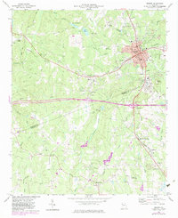
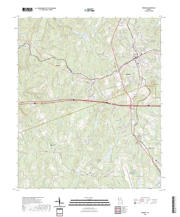
Bremen and the surrounding borderlands of Haralson and Carroll Counties are defined by a network of long-established settlements and institutional landmarks. The Norfolk Southern line serves as a central artery for the region, connecting the industrial and residential core of Bremen to outlying communities like Waco and Budapest. This latter settlement represents a notable point of interest for local historians, as it was established by Hungarian immigrants in the late 19th century to foster a local wine industry.
Find a feature on this map
189 named features on this map. Tap any name to fly to it.
Don’t see what you’re looking for? This feature index may not catch every label — zoom into the map to look around manually.
Map Details
Editions of this 2024 Bremen Map
This is the sole edition of this map. No revisions or reprints were ever made.