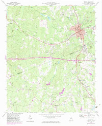
1973 Map of Bremen
USGS Topo · Published 1983About this map
Bremen serves as a significant rail and highway hub on this 1970s survey, where the Southern and Central Of Georgia railroads intersect. This geographic importance is reflected in the surrounding landscape, from the West Georgia Regional Airport to the industrial presence of the Limestone Quarry. The map documents a transition in the region's infrastructure, showing the development of interstate paths alongside traditional country roads that connect long-standing communities like Waco and Budapest.
Find a feature on this map
43 named features on this map. Tap any name to fly to it.
Don’t see what you’re looking for? This feature index may not catch every label — zoom into the map to look around manually.
Map Details
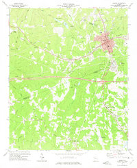
Editions of this 1973 Bremen Map
2 editions found
Other maps of this area

1889 · Tallapoosa
USGS Topo · 1:125,000

1892 · Tallapoosa
USGS Topo · 1:125,000

1897 · Tallapoosa
USGS Topo · 1:125,000

1953 · Atlanta
USGS Topo · 1:250,000

1957 · Atlanta
USGS Topo · 1:250,000

1958 · Atlanta
USGS Topo · 1:250,000

1958 · Carrollton
USGS Topo · 1:62,500

1958 · Buchanan
USGS Topo · 1:62,500

1965 · Tallapoosa South
USGS Topo · 1:24,000

1966 · Tallapoosa North
USGS Topo · 1:24,000