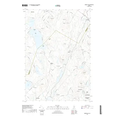
2018 Map of Brewer Lake
USGS Topo · Published 2018About this map
Brewer Lake and its intricate shoreline dominate the northern landscape, where Nickerson Island, King Island, and Bowden Island are prominent features within the water. This modern topography reveals a transition between Brewer in the northwest and Ellsworth in the southeast, characterized by a series of north-south oriented ridges and valleys. Several small burial grounds, such as Copeland Hill Cem and Granite Cem, are scattered throughout the hills, providing valuable locations for genealogists. The southern portion of the map includes the rural crossroads of Winkumpaugh Corners and North Orland, while aviation is marked by the small Philbrick Mountain Airport. The drainage patterns of Eaton Brook, Dane Brook, and Moosehorn Stream illustrate the complex hydrography of the region, connecting various ponds like Long Pond and Saulter Pond across the rugged terrain of the Penobscot and Hancock county line.
Find a feature on this map
112 named features on this map. Tap any name to fly to it.
Don’t see what you’re looking for? This feature index may not catch every label — zoom into the map to look around manually.
Map Details
Editions of this 2018 Brewer Lake Map
This is the sole edition of this map. No revisions or reprints were ever made.
Other maps of this area

1900 · Orland
USGS Topo · 1:62,500

1900 · Bucksport
USGS Topo · 1:62,500

1902 · Orono
USGS Topo · 1:62,500

1902 · Bucksport
USGS Topo · 1:62,500

1902 · Bangor
USGS Topo · 1:62,500

1942 · Orland
USGS Topo · 1:62,500

1942 · Bangor
USGS Topo · 1:62,500

1942 · Bucksport
USGS Topo · 1:62,500

1944 · Orono
USGS Topo · 1:62,500

1946 · Bangor
USGS Topo · 1:62,500