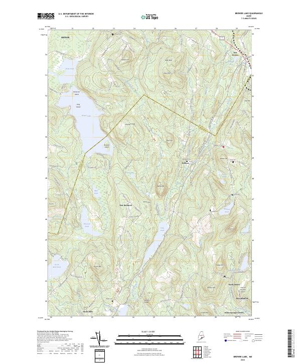
2024 Map of Brewer Lake
USGS Topo · Published 2024About this map
Brewer Lake and the surrounding high ground of the Penobscot and Hancock county line define this landscape of glacial ponds and granite peaks. Small, long-established communities like East Holden and Dedham are connected by a network of rural roads that skirt numerous water bodies, including Fields Pond, Thurston Pond, and the elongated Long Pond. The terrain is marked by prominent elevations such as Stricklen Ridge, Blood Mtn, and Fitz Mtn, while the presence of several family and community burial grounds, such as Hill Rest Cem and Granite Cem, points to the deep generational roots of the area. In the south, the Philbrick Mountain Airport and the intersection at Winkumpaugh Corners serve as modern landmarks within a territory traditionally shaped by timber and small-scale agriculture. The mapping of Moosehorn Stream and Colby Brook illustrates the intricate drainage patterns that have long dictated settlement and land use in this part of Maine.
Find a feature on this map
121 named features on this map. Tap any name to fly to it.
Don’t see what you’re looking for? This feature index may not catch every label — zoom into the map to look around manually.
Map Details
Editions of this 2024 Brewer Lake Map
This is the sole edition of this map. No revisions or reprints were ever made.
Other maps of this area

1900 · Orland
USGS Topo · 1:62,500

1900 · Bucksport
USGS Topo · 1:62,500

1902 · Orono
USGS Topo · 1:62,500

1902 · Bucksport
USGS Topo · 1:62,500

1902 · Bangor
USGS Topo · 1:62,500

1942 · Orland
USGS Topo · 1:62,500

1942 · Bangor
USGS Topo · 1:62,500

1942 · Bucksport
USGS Topo · 1:62,500

1944 · Orono
USGS Topo · 1:62,500

1946 · Bangor
USGS Topo · 1:62,500