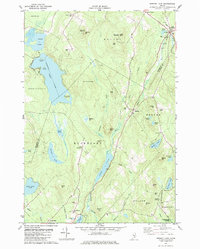
1982 Map of Brewer Lake
USGS Topo · Published 1982About this map
East Holden and Dedham anchor this landscape of glacial ponds and granite ridges in the early 1980s. The Maine Central railroad corridor cuts through the northeast corner, serving a region defined by scattered woodlots and small settlements like East Bucksport and Winkumpaugh Corners. The topography is marked by significant elevations such as Copeland Hill, which hosted multiple communications installations including the Wlbz-TV and Wabi-TV towers on nearby Rider Bluff.
Find a feature on this map
69 named features on this map. Tap any name to fly to it.
Don’t see what you’re looking for? This feature index may not catch every label — zoom into the map to look around manually.
Map Details
Editions of this 1982 Brewer Lake Map
This is the sole edition of this map. No revisions or reprints were ever made.
Other maps of this area

1900 · Orland
USGS Topo · 1:62,500

1900 · Bucksport
USGS Topo · 1:62,500

1902 · Orono
USGS Topo · 1:62,500

1902 · Bucksport
USGS Topo · 1:62,500

1902 · Bangor
USGS Topo · 1:62,500

1942 · Orland
USGS Topo · 1:62,500

1942 · Bangor
USGS Topo · 1:62,500

1942 · Bucksport
USGS Topo · 1:62,500

1944 · Orono
USGS Topo · 1:62,500

1946 · Bangor
USGS Topo · 1:62,500