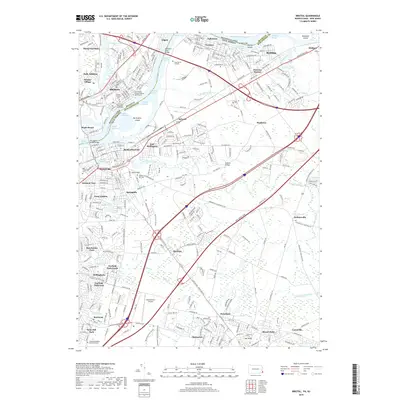
2019 Map of Bristol
USGS Topo · Published 2019About this map
Bristol and Burlington anchor this detailed study of the riverfront corridor along the Delaware River, where the historic industrial and transit legacy of Pennsylvania and New Jersey meets. The map documents a dense network of suburban developments such as Willingboro and Roebling, alongside significant cultural landmarks like the Saint Marks Roman Catholic Churchyard and the historically noted settlement of Timbucktoo. The river itself is a complex series of navigational channels, including the Lehigh Channel and Devlin Channel, which skirt the large Burlington Island. Land use patterns show a distinct mix of early Quaker influence, seen at the Rancocas Quaker Burying Ground, and modern infrastructure like the Inductotherm Airport and the New Jersey Tpke, illustrating the region's evolution from colonial river crossings to a major mid-Atlantic transportation hub.
Find a feature on this map
73 named features on this map. Tap any name to fly to it.
Don’t see what you’re looking for? This feature index may not catch every label — zoom into the map to look around manually.
Map Details
Editions of this 2019 Bristol Map
This is the sole edition of this map. No revisions or reprints were ever made.
Other maps of this area

1888 · Bordentown
USGS Topo · 1:62,500

1888 · Pemberton
USGS Topo · 1:62,500

1888 · Mount Holly
USGS Topo · 1:62,500

1890 · Burlington
USGS Topo · 1:62,500

1893 · Bordentown
USGS Topo · 1:62,500

1893 · Burlington
USGS Topo · 1:62,500

1894 · Pemberton
USGS Topo · 1:62,500

1894 · Mount Holly
USGS Topo · 1:62,500

1898 · Pemberton
USGS Topo · 1:62,500

1898 · Mount Holly
USGS Topo · 1:62,500
Featured Places
- Falls Township, PA
- Willingboro Township, NJ
- Bordentown Township, NJ
- Florence Township, NJ
- Mount Holly Township, NJ