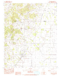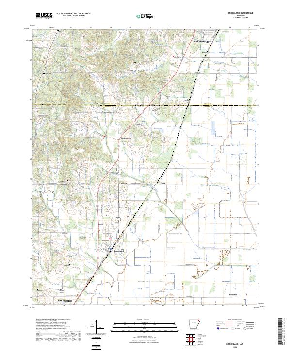
2024 Map of Brookland
USGS Topo · Published 2024About this map
Crowleys Ridge rises above the surrounding flatlands in this detailed map of the borderlands between Greene and Craighead counties. The geography is defined by a north-south alignment of small communities and rural settlements, including Brookland, Goobertown, Antioch, and Tunis, many of which are linked by the modern highway corridor. The map reveals a dense network of local roads that weave through the varying elevations of the ridge and the agricultural plains, providing a modern perspective on historic land divisions.
Find a feature on this map
116 named features on this map. Tap any name to fly to it.
Don’t see what you’re looking for? This feature index may not catch every label — zoom into the map to look around manually.
Map Details
Editions of this 2024 Brookland Map
This is the sole edition of this map. No revisions or reprints were ever made.