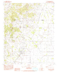
1983 Map of Brookland
USGS Topo · Published 1984About this map
Crowleys Ridge dominates the western half of this Northeast Arkansas landscape, providing a distinct topographical contrast to the flat drainage basins of the east. This survey, field-checked in the late 1970s, captures the transition from the wooded elevations of the ridge to the engineered agricultural lands of the St. Francis River basin. The St Louis Southwestern railroad corridor anchors the settlement of Brookland, serving as a primary transit artery through the county. Moving north, smaller rural communities and place names like Goobertown, Antioch, and Bethel appear alongside numerous country churches, including Woods Chapel and Liberty Ch. The eastern lowlands are defined by an extensive water management network of man-made channels such as Lateral No 1 and Bank Ditch, which turned the former wetlands into productive farmland. Genealogists will find value in the precise locations of several family and community burial grounds, including Sims Cem and Nobel Cem.
Find a feature on this map
29 named features on this map. Tap any name to fly to it.
Don’t see what you’re looking for? This feature index may not catch every label — zoom into the map to look around manually.
Map Details
Editions of this 1983 Brookland Map
This is the sole edition of this map. No revisions or reprints were ever made.
Other maps of this area

1939 · Jonesboro
USGS Topo · 1:62,500

1940 · Gainesville
USGS Topo · 1:62,500

1940 · Marmaduke
USGS Topo · 1:62,500

1941 · Leachville
USGS Topo · 1:62,500

1953 · Memphis
USGS Topo · 1:250,000

1956 · Leachville
USGS Topo · 1:62,500

1956 · Memphis
USGS Topo · 1:250,000

1957 · Poplar Bluff
USGS Topo · 1:250,000

1958 · Jonesboro
USGS Topo · 1:62,500

1958 · Marmaduke
USGS Topo · 1:62,500