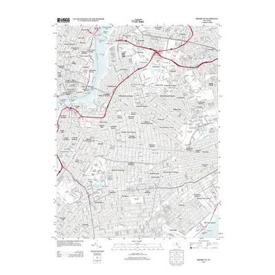
2013 Map of Brooklyn
USGS Topo · Published 2013About this map
Prospect Park serves as a massive central anchor for this urban landscape, surrounded by the distinctive neighborhoods of Clinton Hill, Adelphi, and Flatbush. The map reveals a dense network of residential housing developments such as Ebbets Field Houses and Atlantic Terminal Houses, indicating the mid-century evolution of the city's housing footprint. Along the East River, the industrial and maritime legacy is visible through Dry Dock Number 1 and various shipping piers, while the interior is dotted with significant religious and commemorative sites like Cem of the Holy Cross and the Ridgewood Masonic Temple. Infrastructure defines the boundaries of these communities, from the heavy rail corridors of Bushwick Yards to the massive bridge spans including the Kosciuszko Bridge and the Williamsburg Bridge, illustrating how transport and transit systems have historically carved the boroughs into their modern shapes.
Find a feature on this map
151 named features on this map. Tap any name to fly to it.
Don’t see what you’re looking for? This feature index may not catch every label — zoom into the map to look around manually.
Map Details
Editions of this 2013 Brooklyn Map
This is the sole edition of this map. No revisions or reprints were ever made.
Other maps of this area

1888 · Paterson
USGS Topo · 1:62,500

1889 · Brooklyn
USGS Topo · 1:62,500

1891 · Brooklyn
USGS Topo · 1:62,500

1891 · Harlem
USGS Topo · 1:62,500

1892 · Paterson
USGS Topo · 1:62,500

1897 · Harlem
USGS Topo · 1:62,500

1897 · Brooklyn
USGS Topo · 1:62,500

1898 · Harlem
USGS Topo · 1:62,500

1898 · Staten Island
USGS Topo · 1:62,500

1898 · Brooklyn
USGS Topo · 1:62,500