2023 Map of Broomes Island
USGS Topo · Published 2023About this map
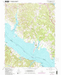
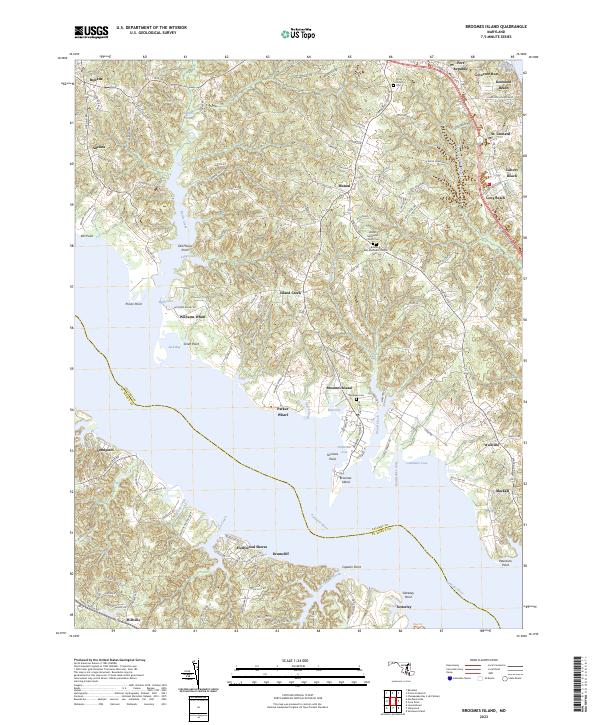
The Patuxent River divides Calvert and St. Mary's counties in this coastal survey, where the narrow peninsula of Broomes Island sits at the confluence of Island Creek and the river. The landscape reflects centuries of maritime activity and agricultural settlement, with landing points like Williams Wharf and Parker Wharf marking old commerce hubs along the riverbanks. The interior is defined by deeply dissected creek valleys and wooded tracts such as Cypress Swamp, which feeds into Battle Creek. Notable landmarks include Sotterley on the southern shore and several local congregations like Christ Church and Waters Methodist Church. Small waterfront communities, including Governor Run and Kenwood Beach, dot the eastern shoreline along the Chesapeake Bay, while established inland hamlets like Mutual and Adelina anchor the peninsula's rural road network.
Find a feature on this map
137 named features on this map. Tap any name to fly to it.
Don’t see what you’re looking for? This feature index may not catch every label — zoom into the map to look around manually.
Map Details
Editions of this 2023 Broomes Island Map
This is the sole edition of this map. No revisions or reprints were ever made.