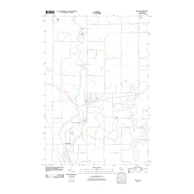
2010 Map of Brule
USGS Topo · Published 2010About this map
The Bois Brule River snakes through this Douglas County landscape, serving as a central geographical artery for northern Wisconsin recreation and conservation. Along its winding course, the Wisconsin State Fish Hatchery and Copper Range Campground highlight the area's long-standing connection to natural resource management and outdoor tourism. The small settlement of Brule sits at the crossing of the Tri County Corridor, a former rail line repurposed for regional transit. To the south, the village of Winneboujou rests near the confluence where the Little Bois Brule River joins the main branch. The eastern half of the map is defined by a dense network of glacial lakes, including Carroll Lake, Lindgren Lake, and Camp Eleven Lake, interspersed with local cemeteries like Pine Ridge Cemetery and Pine Glade Cemetery that anchor the community's history.
Find a feature on this map
63 named features on this map. Tap any name to fly to it.
Don’t see what you’re looking for? This feature index may not catch every label — zoom into the map to look around manually.
Map Details
Editions of this 2010 Brule Map
This is the sole edition of this map. No revisions or reprints were ever made.
Other maps of this area

1943 · Iron Lake
USGS Topo · 1:48,000

1944 · Drummond
USGS Topo · 1:48,000

1945 · Highland
USGS Topo · 1:48,000

1947 · Drummond
USGS Topo · 1:48,000

1947 · Brule
USGS Topo · 1:48,000

1947 · Iron Lake
USGS Topo · 1:48,000

1949 · Highland
USGS Topo · 1:48,000

1953 · Ashland
USGS Topo · 1:250,000

1954 · Lake Nebagamon
USGS Topo · 1:24,000

1954 · Cloverland
USGS Topo · 1:24,000