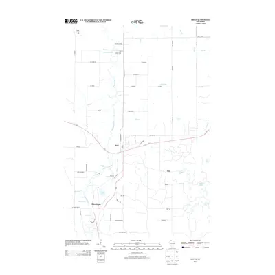
2013 Map of Brule
USGS Topo · Published 2013About this map
The Bois Brule River snakes northward through this 2013 landscape, defining the character of the settlements at Brule and Winneboujou. This corridor is defined by its series of distinct river features, including Doodlebug Rapids, Little Joe Rapids, and Williamson Rapids, which emphasize the area's identity as a destination for water-based activities and conservation. The Wisconsin State Fish Hatchery is a significant local landmark near the junction of Wi-27 and the river, reflecting the region's long-standing focus on natural resource management and wildlife. Away from the main river channel, the terrain rises toward Sugar Camp Hill and is dotted with several small water bodies such as Hoodoo Lake, Lindgren Lake, and Carroll Lake. The network of backroads, including Afterhours Rd and Old Highway 2, provides access to the Copper Range Campground and the eastern settlement of Wills.
Find a feature on this map
75 named features on this map. Tap any name to fly to it.
Don’t see what you’re looking for? This feature index may not catch every label — zoom into the map to look around manually.
Map Details
Editions of this 2013 Brule Map
This is the sole edition of this map. No revisions or reprints were ever made.
Other maps of this area

1943 · Iron Lake
USGS Topo · 1:48,000

1944 · Drummond
USGS Topo · 1:48,000

1945 · Highland
USGS Topo · 1:48,000

1947 · Drummond
USGS Topo · 1:48,000

1947 · Brule
USGS Topo · 1:48,000

1947 · Iron Lake
USGS Topo · 1:48,000

1949 · Highland
USGS Topo · 1:48,000

1953 · Ashland
USGS Topo · 1:250,000

1954 · Lake Nebagamon
USGS Topo · 1:24,000

1954 · Cloverland
USGS Topo · 1:24,000