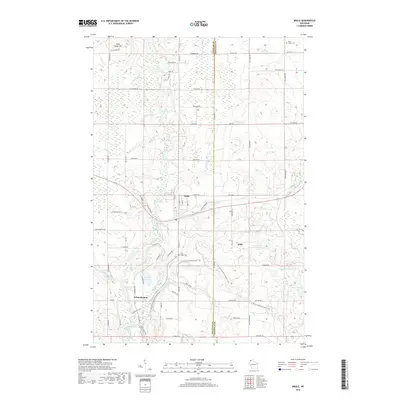
2018 Map of Brule
USGS Topo · Published 2018About this map
Brule serves as the central hub of this northern Wisconsin landscape, where the Bois Brule River and its intricate series of whitewater features dominate the terrain. The river's character is defined by its numerous named rapids, including Doodlebug Rapids, Long Nebagamon Rapids, and Station Rapids, which descend through the township toward Lake Superior. The settlement of Winneboujou and the small siding at Wills illustrate the local reliance on the river and rail corridors. Higher ground is marked by Sugar Camp Hill in the northwest and Pine Ridge Cem near the town center. The presence of numerous trails and fire roads, such as Fire Tower Rd, points to the area's legacy of forest management and outdoor recreation. Large wetlands and tributary creeks like Nebagamon Cr and Fish Cr feed into the main river valley, creating a complex hydrological network through Douglas and Bayfield counties.
Find a feature on this map
88 named features on this map. Tap any name to fly to it.
Don’t see what you’re looking for? This feature index may not catch every label — zoom into the map to look around manually.
Map Details
Editions of this 2018 Brule Map
This is the sole edition of this map. No revisions or reprints were ever made.
Other maps of this area

1943 · Iron Lake
USGS Topo · 1:48,000

1944 · Drummond
USGS Topo · 1:48,000

1945 · Highland
USGS Topo · 1:48,000

1947 · Drummond
USGS Topo · 1:48,000

1947 · Brule
USGS Topo · 1:48,000

1947 · Iron Lake
USGS Topo · 1:48,000

1949 · Highland
USGS Topo · 1:48,000

1953 · Ashland
USGS Topo · 1:250,000

1954 · Lake Nebagamon
USGS Topo · 1:24,000

1954 · Cloverland
USGS Topo · 1:24,000