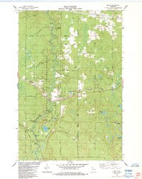
1984 Map of Brule
USGS Topo · Published 1984About this map
The Bois Brule River winds through the heart of the Brule River State Forest in this mid-1980s survey, defining a landscape of recreational value and natural resources. The settlement of Brule serves as a central hub, situated where the Burlington Northern railroad corridor meets the river. The map records several notable rapids including Doodlebug Rapids and Little Joe Rapids, highlighting the river's character before it reaches the State Fish Hatchery downstream.
Find a feature on this map
56 named features on this map. Tap any name to fly to it.
Don’t see what you’re looking for? This feature index may not catch every label — zoom into the map to look around manually.
Map Details
Editions of this 1984 Brule Map
This is the sole edition of this map. No revisions or reprints were ever made.
Other maps of this area

1943 · Iron Lake
USGS Topo · 1:48,000

1944 · Drummond
USGS Topo · 1:48,000

1945 · Highland
USGS Topo · 1:48,000

1947 · Drummond
USGS Topo · 1:48,000

1947 · Brule
USGS Topo · 1:48,000

1947 · Iron Lake
USGS Topo · 1:48,000

1949 · Highland
USGS Topo · 1:48,000

1953 · Ashland
USGS Topo · 1:250,000

1954 · Lake Nebagamon
USGS Topo · 1:24,000

1954 · Cloverland
USGS Topo · 1:24,000