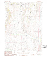
1986 Map of Buckhorn Ridge
USGS Topo · Published 1987About this map
Humboldt National Forest lands dominate this high-elevation portion of Elko County, where the hydrological divide of Buckhorn Ridge separates various drainage basins. The map documents a landscape defined by seasonal water and cattle grazing, with prominent features like Pasture and the curiously named Choke-a-Man Draw. Water sources are vital in this arid environment, represented by Elk Spring and the perennial flows of Pole Creek and O'Neil Creek. To the southeast, the terrain opens into the O'Neil Basin, where the South Fork Salmon Falls Creek begins its course. This 1980s provisional survey captures the remote character of the Nevada backcountry, showing the network of unimproved roads and 4WD tracks that provided the only access for forest rangers and ranchers.
Find a feature on this map
13 named features on this map. Tap any name to fly to it.
Don’t see what you’re looking for? This feature index may not catch every label — zoom into the map to look around manually.
Map Details
Editions of this 1986 Buckhorn Ridge Map
This is the sole edition of this map. No revisions or reprints were ever made.
Other maps of this area

1955 · Wells
USGS Topo · 1:250,000

1957 · Contact
USGS Topo · 1:62,500

1957 · Elk Mountain
USGS Topo · 1:62,500

1958 · Wells
USGS Topo · 1:250,000

1961 · Wells
USGS Topo · 1:250,000

1968 · Hubbard Basin
USGS Topo · 1:24,000
1968 · Gilmer Ranch
USGS Topo · 1:24,000
1970 · Sun Creek NW
USGS Topo · 1:24,000
1981 · Jarbidge Mts
USGS Topo · 1:100,000

1982 · Jackpot
USGS Topo · 1:100,000