Loading...
Loading map...2022 Map of Bucyrus
USGS Topo · Published 2022About this map
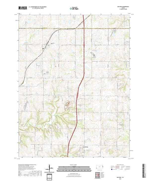
Bucyrus and the surrounding Miami County agricultural lands are defined by a network of sectional roads and the winding path of N Wea Cr. This rural landscape is dotted with small-scale aviation facilities, including Chiles Airpark, Albright Airport, and the Pine Sod Ranch Airport in the northeast. The settlement at Wea centers around the Queen of the Holy Rosary Cem, while the northern outskirts of Louisburg appear at the southern edge of the sheet.
Find a feature on this map
64 named features on this map. Tap any name to fly to it.
Don’t see what you’re looking for? This feature index may not catch every label — zoom into the map to look around manually.
Map Details
Date Portrayed2022
Date Published2022
PublisherU.S. Geological Survey
Map TypeTopographic
Scale1:24000
Physical Dimensions24 x 29 inches
Editions of this 2022 Bucyrus Map
This is the sole edition of this map. No revisions or reprints were ever made.
Historical Maps of Johnson County Through Time
Featured Locations
Source Details
SourceU.S. Geological Survey
CopyrightPublic Domain