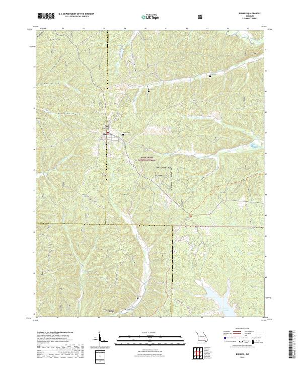
2021 Map of Bunker
USGS Topo · Published 2021About this map
Bunker serves as the central hub of this Missouri Ozarks landscape, situated at the junction of State Hwy A and State Hwy PP. The map reveals a deeply dissected terrain within the Mark Twain National Forest, where steep ridges and narrow hollows dictate the layout of rural infrastructure. Water plays a defining role in the local geography, from the named flow of Big Creek and Bee Fork to smaller drainages like Little Sinking Creek and Adler Creek. Family and community history is preserved in several burial sites throughout the township, including Parks Cemetery and Estep Cemetery. A notable geological feature, the Turner Natural Bridge, is documented south of the town center near Turner Cemetery, illustrating the karst topography characteristic of the region. The map also traces the county lines where Dent, Reynolds, and Shannon counties meet, highlighting how these administrative boundaries follow the winding ridges and stream beds.
Find a feature on this map
43 named features on this map. Tap any name to fly to it.
Don’t see what you’re looking for? This feature index may not catch every label — zoom into the map to look around manually.
Map Details
Editions of this 2021 Bunker Map
This is the sole edition of this map. No revisions or reprints were ever made.
Other maps of this area

1941 · Stone Hill
USGS Topo · 1:62,500

1943 · Boss
USGS Topo · 1:62,500

1944 · Corridon
USGS Topo · 1:62,500

1945 · Stone Hill
USGS Topo · 1:62,500

1945 · Round Spring
USGS Topo · 1:62,500

1946 · Boss
USGS Topo · 1:62,500

1947 · Sinkin
USGS Topo · 1:48,000

1947 · Corridon
USGS Topo · 1:62,500

1949 · Round Spring
USGS Topo · 1:62,500

1949 · Rolla
USGS Topo · 1:250,000