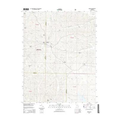
2015 Map of Bunker
USGS Topo · Published 2015About this map
Bunker and West Bunker sit at the intersection of Dent and Reynolds Counties, serving as the primary settlements in this portion of the Ozark Highlands. This 2015 update shows a landscape defined by the deep valleys and ridges of the Mark Twain National Forest, where drainage systems like Bee Fork and Big Cr carve through the terrain. The map is particularly useful for local historians, as it meticulously identifies numerous family and community landmarks, including the Parks Cemetery, Estep Cemetery, and Turner Cemetery. A notable geological feature, the Turner Natural Bridge, is documented near the banks of Big Cr in the southern portion of the quadrangle. The survey also captures smaller, perhaps forgotten locales like Melton and numerous hollows such as Jayhawker Hollow and Improvement Hollow, reflecting the rural character of the region.
Find a feature on this map
48 named features on this map. Tap any name to fly to it.
Don’t see what you’re looking for? This feature index may not catch every label — zoom into the map to look around manually.
Map Details
Editions of this 2015 Bunker Map
This is the sole edition of this map. No revisions or reprints were ever made.
Other maps of this area

1941 · Stone Hill
USGS Topo · 1:62,500

1943 · Boss
USGS Topo · 1:62,500

1944 · Corridon
USGS Topo · 1:62,500

1945 · Stone Hill
USGS Topo · 1:62,500

1945 · Round Spring
USGS Topo · 1:62,500

1946 · Boss
USGS Topo · 1:62,500

1947 · Sinkin
USGS Topo · 1:48,000

1947 · Corridon
USGS Topo · 1:62,500

1949 · Round Spring
USGS Topo · 1:62,500

1949 · Rolla
USGS Topo · 1:250,000