
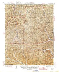
1946 Map of Boss
USGS Topo · Published 1946About this map
Old Mill Lodge stands near the northern boundary of this Ozark plateau landscape, which is defined by the headwaters and drainages of the Black River. The mid-1940s topography reveals a rural network of small settlements and neighborhood centers including Boss, Viburnum, and Greeley. The reliance on local institutions is evident through the naming of numerous country schools and churches, such as Hickory Grove Ch and Rocky Ford Sch, which served families across the dispersed hollows.
Find a feature on this map
75 named features on this map. Tap any name to fly to it.
Don’t see what you’re looking for? This feature index may not catch every label — zoom into the map to look around manually.
Map Details
Editions of this 1946 Boss Map
2 editions found
Other maps of this area

1906 · Potosi
USGS Topo · 1:62,500

1924 · Edgehill
USGS Topo · 1:62,500

1926 · Edgehill
USGS Topo · 1:62,500

1932 · Steelville
USGS Topo · 1:48,000

1933 · Steelville
USGS Topo · 1:62,500

1937 · Steelville
USGS Topo · 1:62,500

1941 · Stone Hill
USGS Topo · 1:62,500

1943 · Berryman
USGS Topo · 1:62,500

1943 · Lesterville
USGS Topo · 1:62,500

1943 · Boss
USGS Topo · 1:62,500