Old Maps of Iron County, Missouri
Explore 128 old maps of Iron County, spanning from 1924 to today. These high-resolution historic maps reveal how streets, neighborhoods, landmarks, and natural features evolved over time — perfect for genealogy, metal detecting, research, and local history exploration.
What you can do with these maps:
- See how Iron County changed over time: Compare historical maps to modern-day views to trace roads, homesites, rail lines & more.
- View detailed metadata: Each map includes creators, publishers, year, scale, and archive source.
- Overlay maps with satellite & LiDAR: Visualize the past alongside modern tools to explore terrain & human change.
- Trusted historical sources: Maps sourced from the USGS, Library of Congress, and other archives.
- Access maps your way: View online, download high-res files, or order prints for personal or research use.
Start exploring old maps of Iron County to uncover forgotten places, hidden landmarks, and the deep history beneath your feet.
Iron County, MO maps
(128)- 1924 Map of Edgehill, 1962 Print
 1924 Edgehill1962 Print · USGSThe Missouri Ozarks are captured here during the mid-1920s, showing a landscape of remote mountain settlements and small valley farms. Local historians can trace early rural life through landmarks like Maxwells Mill, the Mountainville Store, and the Beulah Land Church.
 - 1926 Map of Edgehill
 1926 Edgehill1926 Print · USGSThe Missouri Ozarks are captured here in the mid-1920s, showing a landscape of remote mountain schools and water-driven industry. Local historians can trace the foundations of Edgehill and Monterey, or locate early landmarks like Maxwells Mill and Council Bluff Church.3 unique versions available
 - 1926 Map of Des Arc, 1960 Print
 1926 Des Arc1960 Print · USGSIron and Wayne County hills are captured here in the mid-1920s, showing a landscape defined by the Missouri Pacific rail line. Genealogists can locate family-named landmarks like Emilys Chapel and numerous rural schoolhouses from Glover Sch to Brunot Sch.2 unique versions available
 - 1929 Map of Des Arc
 1929 Des Arc1929 Print · USGSIron and Madison counties in the late 1920s show a landscape of mountain hollows and railroad towns. Trace the Missouri Pacific line through Des Arc and Annapolis, or locate ancestral sites like Emily's Chapel and the Jewett Sch.3 unique versions available
 - 1937 Map of Ironton
 1937 Ironton1937 Print · USGSThe Arcadia Valley in the late 1930s is documented here during a period of established mining and rail activity. Researchers can trace family roots at Rebel Cem and Algire Cem, or locate rural landmarks like King Sch and the Devils Toll Gate.
 - 1943 Map of Lesterville, 1957 Print
 1943 Lesterville1957 Print · USGSThe Black River forks meet in Reynolds County during the 1940s, revealing a landscape of remote hollows and hilltop schools. Genealogists can trace family names at Dobbins Cem and historic school sites like Harrison Valley Sch or Mayberry Sch.2 unique versions available
 - 1943 Map of Boss, 1963 Print
 1943 Boss1963 Print · USGSThe Ozark highlands of the early 1940s are revealed here through a network of small family settlements and mountain schools. Genealogists can trace family footprints at Old Mill Lodge, Moses Store, or rural burial sites like Abbott Cem.2 unique versions available
 - 1945 Map of Ironton, 1955 Print
 1945 Ironton1955 Print · USGSThe Arcadia Valley and the iron mining district of the St. Francois Mountains are captured here in the mid-1940s. Trace the path of the Missouri Pacific railroad through Pilot Knob and Ironton, or locate family sites like Schwab Cem and Flatwoods Sch.6 unique versions available
 - 1946 Map of Lesterville
 1946 Lesterville1946 Print · USGSReynolds County settlements at the end of the Second World War reveal a landscape of tight-knit valley communities and upland forests. Genealogists can trace family names through landmarks like Shy Cem, Dobbins Mill, and rural schoolhouses such as Skyline Sch.2 unique versions available
 - 1946 Map of Boss
 1946 Boss1946 Print · USGSThe Missouri Ozarks are captured here just after the war, showing the deep hollows and timberlands of the eastern Courtois Hills. Genealogists and researchers can locate family landmarks like Moses Store, the Webb Cem, and numerous rural schoolhouses such as Barton Sch.2 unique versions available
 - 1946 Map of Ironton
 1946 Ironton1946 Print · USGSThe Arcadia Valley and the high peaks of the St. Francois Mountains are captured here in the post-war era. Researchers can trace the Missouri Pacific rail line through historic Ironton or locate family sites like Rebel Cem and Hogan Sch.2 unique versions available
 - 1949 Map of Rolla, 1950 Print
 1949 Rolla1950 Print · USGSThe Missouri Ozarks are captured here just after the war, showing a landscape of deep river valleys and emerging reservoir projects. Genealogists and historians can trace the mining towns of Bonne Terre and Potosi or follow the early route of U.S. Highway 66.
 - 1953 Map of Ironton
 1953 Ironton1953 Print · USGSThe St. Francois Mountains of the Missouri Ozarks are captured here during the mid-century industrial era. Genealogists and historians can trace rail-side settlements like Arcadia and Ironton or find family landmarks such as Rebel Cem and White Sch.
 - 1953 Map of Rolla
 1953 Rolla1953 Print · USGSSoutheast Missouri’s mining towns and timberlands are seen here at the start of the 1950s. Genealogists and historians can trace the rail-and-river economy through local hubs like Fredericktown and the lead-mining heritage of Potosi and Desloge.
 - 1954 Map of Rolla, 1970 Print
 1954 Rolla1970 Print · USGSThe Missouri Ozarks and the historic Lead Belt are captured in the late sixties, showing a landscape of deep river hollows and industrial mines. Researchers can trace the routes of the Missouri Pacific RR to extraction sites like the Iron Mountain Mine or Pea Ridge Mine.2 unique versions available
 - 1958 Map of Rolla
 1958 Rolla1958 Print · USGSThe Missouri Ozarks and the lead-rich hills of the southeast are captured here in the late fifties as timber and mining shaped the local economy. Researchers can locate family landmarks like the Rolla Cemetery or trace old rail lines including the Missouri-Illinois RR and St Louis-San Francisco RR.
 - 1959 Map of Rolla
 1959 Rolla1959 Print · USGSMid-century Missouri is defined here by the deep forests of the Ozarks and the industrial peaks of the St Francois Mountains. Genealogists and historians can trace the development of towns like Potosi and Fredericktown or locate rural landmarks like Dry Fork Church and the Phelps County Courthouse.
 - 1960 Map of Rolla
 1960 Rolla1960 Print · USGSThe Ozark Highlands in the mid-twentieth century reveal a landscape of deep timber and heavy industry. Researchers can trace the rail-and-mine economy through the St Louis-San Francisco RR and the Iron Mountain Mine, alongside the growth of Fort Leonard Wood.
 - 1966 Map of Rolla
 1966 Rolla1966 Print · USGSThe Missouri Ozarks are revealed here in the mid-1960s, showing the intersection of heavy industry and sprawling national forests. Trace the development of the Lead Belt near Flat River or locate family roots in vanished hamlets like Enough and Howes Mill.
 - 1967 Map of Greeley, 1968 Print
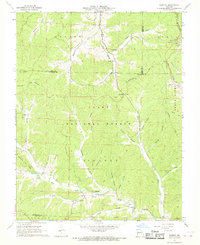 1967 Greeley1968 Print · USGSThe Missouri Ozarks are shown here in the late sixties, where the deep hollows of the Mark Twain National Forest meet industrial growth. Genealogists and hikers can trace the Karkaghne Trail past Greeley, Crossville, and the Buick Mine.3 unique versions available
 - 1967 Map of Viburnum East, 1968 Print
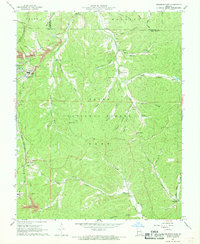 1967 Viburnum East1968 Print · USGSIron and Dent counties are shown here during the 1960s expansion of the Missouri New Lead Belt. Genealogists and local historians can trace the foundations of mining at the Viburnum Mine or locate family sites like Abbott Cem and the West End Sch.5 unique versions available
 - 1967 Map of Oates, 1968 Print
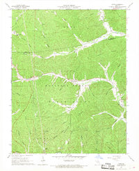 1967 Oates1968 Print · USGSThe northern Ozarks come into focus in the mid-1960s, showing a remote landscape of mining and forestry. Researchers can locate numerous family burial grounds like Trolinger Cem and Smith Cem or trace industry at the Buick Mine.2 unique versions available
 - 1967 Map of Viburnum West, 1968 Print
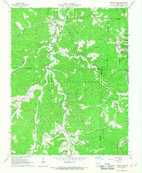 1967 Viburnum West1968 Print · USGSThe Missouri Ozarks during the mid-sixties reveal a landscape transitioning from timber and farming to industrial mining. Researchers can trace family history at Dillard Cem or locate old industrial infrastructure like the Old Railroad Grade and the St Louis-San Francisco line.5 unique versions available
 - 1968 Map of Brunot, 1969 Print
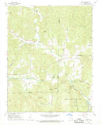 1968 Brunot1969 Print · USGSThe rural hills of Iron and Wayne counties are captured here in the late sixties as the local landscape remained deeply tied to its branching creek valleys. Genealogists and researchers can locate several remote burial sites such as Brewington Cem and Hunter Cem or trace the boundaries of Sam A Baker State Park.3 unique versions available
 - 1968 Map of Johnson Mountain, 1969 Print
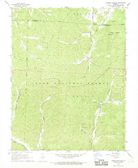 1968 Johnson Mountain1969 Print · USGSIron and Washington Counties in the late 1960s are characterized by the dense timber of the Clark National Forest and high Ozark peaks. Researchers can locate remote settlements like Enough and Redmondville alongside old landmarks like Ottery Ch and Rencehausen Cem.3 unique versions available
Showing maps 1-25 of 128
Top cities of Iron County
- Ironton historical maps
- Viburnum historical maps
- Pilot Knob historical maps
- Arcadia historical maps
- Annapolis historical maps
- Des Arc historical maps
Frequently asked questions
- What are the different types of historical maps available for Iron County?
- What is the oldest map of Iron County?
- Where can I purchase historical maps of Iron County for my home or office?
- Where can I download high-res historical maps of Iron County?
- Are there historical topographic maps available for Iron County?
- Is there historical aerial imagery available for Iron County?
- Where are historical maps of Iron County sourced from?