2024 Map of Bunnell
USGS Topo · Published 2024About this map
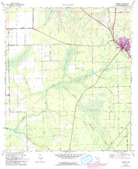
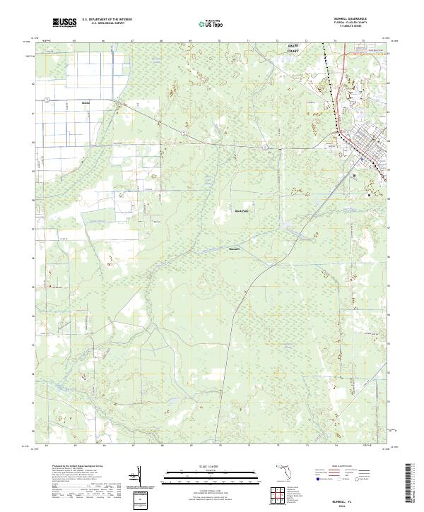
Bunnell serves as the focal point of this Flagler County survey, where the intersection of traditional agricultural roads and modern transit corridors meets a complex hydrologic landscape. The region is defined by an extensive network of drainage and wetlands, including Big Cypress Swamp and Sweetwater Swamp, which are managed through features like the Black Branch Canal. The presence of Black Point and numerous creek branches, such as Little Black Branch and Middle Haw Creek, illustrates the delicate balance of land use in this part of Florida. In the northern reaches, the community of Bimini and the edge of Palm Coast indicate the encroachment of residential development into the cypress and swamp lands. For local history, the map preserves the alignment of older routes like Old Haw Creek Rd and the Lehigh Greenway Trl, reflecting the area's transition from rail and rural transit to recreational use.
Find a feature on this map
60 named features on this map. Tap any name to fly to it.
Don’t see what you’re looking for? This feature index may not catch every label — zoom into the map to look around manually.
Map Details
Editions of this 2024 Bunnell Map
This is the sole edition of this map. No revisions or reprints were ever made.