
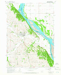
1964 Map of Burbank
USGS Topo · Published 1966About this map
The Missouri River serves as the central artery and the shifting border between South Dakota and Nebraska in this mid-1960s study. The settlement of Burbank sits on the northern plains of Clay County, positioned along the Chicago Milwaukee railroad and the St Paul and Pacific line. This area illustrates the transition from the flat river valley, characterized by Burbank Lake, to the dissected bluffs on the Nebraska side.
Find a feature on this map
27 named features on this map. Tap any name to fly to it.
Don’t see what you’re looking for? This feature index may not catch every label — zoom into the map to look around manually.
Map Details
Editions of this 1964 Burbank Map
This is the sole edition of this map. No revisions or reprints were ever made.
Other maps of this area

1898 · Elk Point
USGS Topo · 1:125,000

1901 · Elk Point
USGS Topo · 1:125,000

1907 · Elk Point
USGS Topo · 1:125,000

1955 · Sioux City
USGS Topo · 1:250,000

1958 · Sioux City
USGS Topo · 1:250,000

1959 · Sioux City
USGS Topo · 1:250,000

1963 · Elk Point
USGS Topo · 1:24,000

1964 · Martinsburg SW
USGS Topo · 1:24,000

1964 · Maskell
USGS Topo · 1:24,000
1964 · Ponca
USGS Topo · 1:24,000