2022 Map of Burgaw
USGS Topo · Published 2022About this map
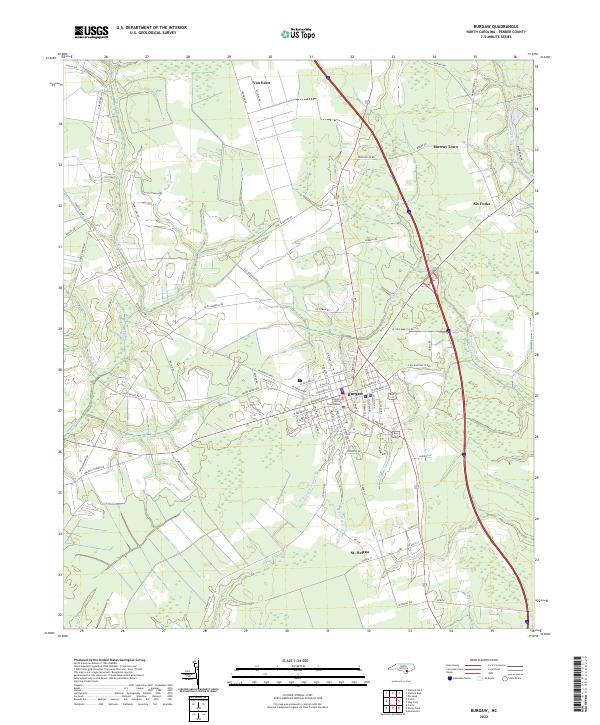
The Pender County Courthouse serves as the focal point for this survey of the county seat at Burgaw. The town’s grid is clearly defined, with streets such as E Wilmington St Exd and W Stag Park Svc Rd radiating toward the surrounding agricultural and timber lands. To the south lies St. Helena, a community with a distinct identity rooted in its historical role as a center for immigrant agriculture. The landscape is heavily influenced by a network of local waterways, including the Northeast Cape Fear River which forms the eastern boundary. Smaller tributaries like the W Prong of Osgood Br and Little Burgaw Cr weave through the lowlands, shaping the development of rural settlements such as Van Eden and Murray Town. This modern topographic study illustrates the transition between the urban core of Burgaw and the river-dependent rural outposts like Six Forks.
Find a feature on this map
88 named features on this map. Tap any name to fly to it.
Don’t see what you’re looking for? This feature index may not catch every label — zoom into the map to look around manually.
Map Details
Editions of this 2022 Burgaw Map
This is the sole edition of this map. No revisions or reprints were ever made.