Loading...
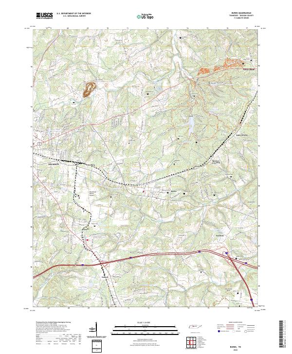
Loading map...2022 Map of Burns
USGS Topo · Published 2022About this map
The Tennessee Valley Divide cuts through this portion of Dickson County, separating the drainage of numerous creeks and branches. The settlement of Burns serves as a central point, surrounded by a network of smaller communities including Colesburg, Tidwell, and Pomona. The landscape is defined by its deep hollows, such as Wildcat Hollow, Jackson Hollow, and Creech Hollow, many of which harbor small lakes and springs.
Find a feature on this map
227 named features on this map. Tap any name to fly to it.
Don’t see what you’re looking for? This feature index may not catch every label — zoom into the map to look around manually.
Map Details
Date Portrayed2022
Date Published2022
PublisherU.S. Geological Survey
Map TypeTopographic
Scale1:24000
Physical Dimensions24 x 29 inches
Editions of this 2022 Burns Map
This is the sole edition of this map. No revisions or reprints were ever made.
Historical Maps of Tidwell Through Time
Featured Locations
Source Details
SourceU.S. Geological Survey
CopyrightPublic Domain