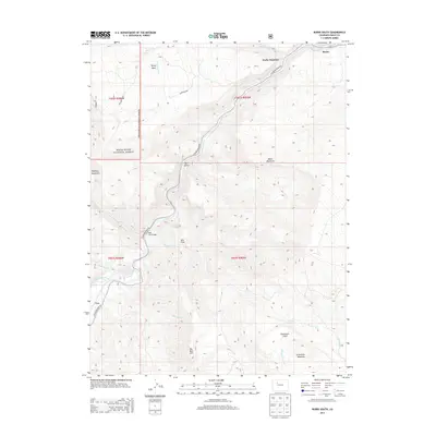
2013 Map of Burns South
USGS Topo · Published 2013About this map
The Colorado River carves a deep path through Eagle County, serving as the primary geographical anchor for this high-elevation region near Burns and Derby Junction. This landscape is defined by the transition from river bottomlands to prominent peaks like Greenhorn Mountain and Black Mountain. Human infrastructure is closely tied to the water, with Colorado River Rd following the river’s edge and the Red Dirt Bridge providing a vital crossing point. To the west, the boundaries of the White River National Forest encompass vast tracts of upland terrain, including Derby Mesa and Porphyry Mountain. Water management is evident through features like the S Derby Ditch and Price Reservoir, illustrating how early 21st-century ranching and local water rights shaped the utilization of the mountain tributaries.
Find a feature on this map
29 named features on this map. Tap any name to fly to it.
Don’t see what you’re looking for? This feature index may not catch every label — zoom into the map to look around manually.
Map Details
Editions of this 2013 Burns South Map
This is the sole edition of this map. No revisions or reprints were ever made.
Other maps of this area

1927 · Glenwood Springs
USGS Topo · 1:125,000

1930 · Glenwood Springs
USGS Topo · 1:125,000

1957 · Leadville
USGS Topo · 1:250,000

1959 · Leadville
USGS Topo · 1:250,000

1960 · Leadville
USGS Topo · 1:250,000

1962 · Leadville
USGS Topo · 1:250,000

1962 · Gypsum
USGS Topo · 1:24,000

1962 · Eagle
USGS Topo · 1:24,000

1964 · Leadville
USGS Topo · 1:250,000

1972 · Blue Hill
USGS Topo · 1:24,000