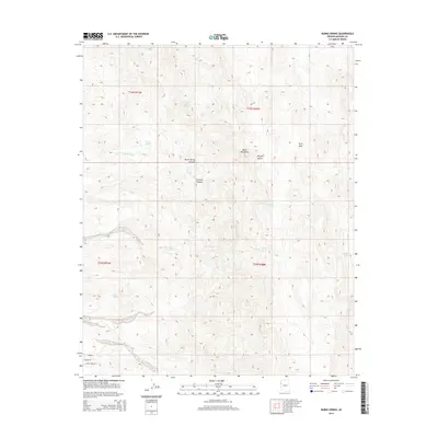
2014 Map of Burns Spring
USGS Topo · Published 2014About this map
Black Mountains topography dominates this high-desert landscape in northwestern Arizona. The drainage patterns here are defined by significant ephemeral watercourses such as Granite Wash and Tyro Wash, which carve through the arid terrain. While much of the area is characterized by the open reaches of the Mojave Desert, the presence of reliable water sources like Burns Spring, Chalk Spring, and Willow Spring suggests the historic importance of this quadrangle for ranching and transit. These springs are often tucked into steep relief, such as within Burns Spring Canyon or near the geological transition at Granite Wash Canyon. Evidence of early twentieth-century industry or water management appears at Twin Mills, while modern access is limited to a few residential roads at the southern edge, including Mohave Ln and E Gold Stake Pl.
Find a feature on this map
19 named features on this map. Tap any name to fly to it.
Don’t see what you’re looking for? This feature index may not catch every label — zoom into the map to look around manually.
Map Details
Editions of this 2014 Burns Spring Map
This is the sole edition of this map. No revisions or reprints were ever made.
Other maps of this area

1886 · Camp Mohave
USGS Topo · 1:250,000

1892 · Camp Mohave
USGS Topo · 1:250,000

1926 · Mohave City
USGS Topo · 1:96,000

1942 · Camp Mohave
USGS Topo · 1:250,000

1947 · Kingman
USGS Topo · 1:250,000

1948 · Kingman
USGS Topo · 1:250,000

1950 · Davis Dam
USGS Topo · 1:62,500

1952 · Davis Dam
USGS Topo · 1:62,500

1954 · Kingman
USGS Topo · 1:250,000

1955 · Kingman
USGS Topo · 1:250,000