2024 Map of Byron
USGS Topo · Published 2024About this map
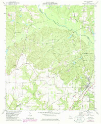
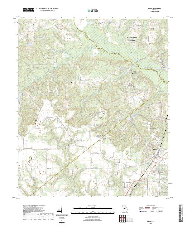
Byron sits at the convergence of local infrastructure and shifting county lines where Peach, Crawford, and Bibb counties meet. The landscape is defined by a dense network of watercourses, including the winding Echeconnee Creek and the headwaters of Juniper Creek and Whitewater Creek. Genealogists will find significant value in the numerous family burial grounds and community sites scattered across the rural countryside, such as the Nimrod Jackson Family Cem and the Society Hill Cem. The area around Friendship shows the persistent rural character of middle Georgia, anchored by the Jordan Chapel United Methodist Church and its accompanying cemetery. This survey captures a balance between the growing residential clusters near the town center and the preserved family landmarks that remain in the outlying creek valleys.
Find a feature on this map
141 named features on this map. Tap any name to fly to it.
Don’t see what you’re looking for? This feature index may not catch every label — zoom into the map to look around manually.
Map Details
Editions of this 2024 Byron Map
This is the sole edition of this map. No revisions or reprints were ever made.