2023 Map of Cairo
USGS Topo · Published 2023About this map
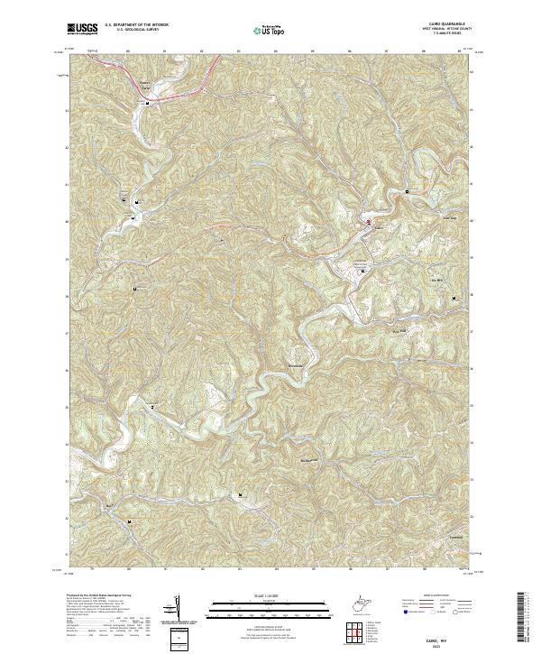
The North Fork Hughes River carves a winding path through this Ritchie County landscape, serving as the central artery for settlements like Riverside and Rutherford. The town of Cairo sits at a strategic bend where the North Bend Rail-Trl follows the river valley, marking a transition from historic industrial use to modern recreation. This rail corridor is flanked by steep terrain and numerous tributaries such as Goose Creek and Devilhole Creek, which have dictated the placement of rural roads and homesteads for generations.
Find a feature on this map
87 named features on this map. Tap any name to fly to it.
Don’t see what you’re looking for? This feature index may not catch every label — zoom into the map to look around manually.
Map Details
Editions of this 2023 Cairo Map
This is the sole edition of this map. No revisions or reprints were ever made.