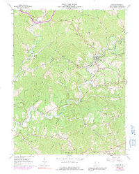
1964 Map of Cairo
USGS Topo · Published 1991About this map
Cairo serves as the focal point of this Ritchie County landscape, situated at the confluence of several runs and the North Fork Hughes River. The mid-20th-century character of the region is defined by the Baltimore and Ohio railroad corridor, which tunnels through the hills at Tunnel No 19 near Silver Run Station. The topography is densely packed with family-named cemeteries and rural landmarks, including Rexroad Cem, Swisher Cem, and Metz Cem, indicating a long-established pattern of upland settlement.
Find a feature on this map
67 named features on this map. Tap any name to fly to it.
Don’t see what you’re looking for? This feature index may not catch every label — zoom into the map to look around manually.
Map Details
Editions of this 1964 Cairo Map
3 editions found
Other maps of this area

1904 · Marietta
USGS Topo · 1:62,500

1906 · Saint Marys
USGS Topo · 1:62,500

1906 · Elizabeth
USGS Topo · 1:62,500

1907 · Harrisville
USGS Topo · 1:62,500

1924 · St Marys
USGS Topo · 1:62,500

1924 · Harrisville
USGS Topo · 1:62,500

1924 · Marietta
USGS Topo · 1:62,500

1924 · Elizabeth
USGS Topo · 1:62,500

1926 · Elizabeth
USGS Topo · 1:62,500

1926 · Harrisville
USGS Topo · 1:62,500